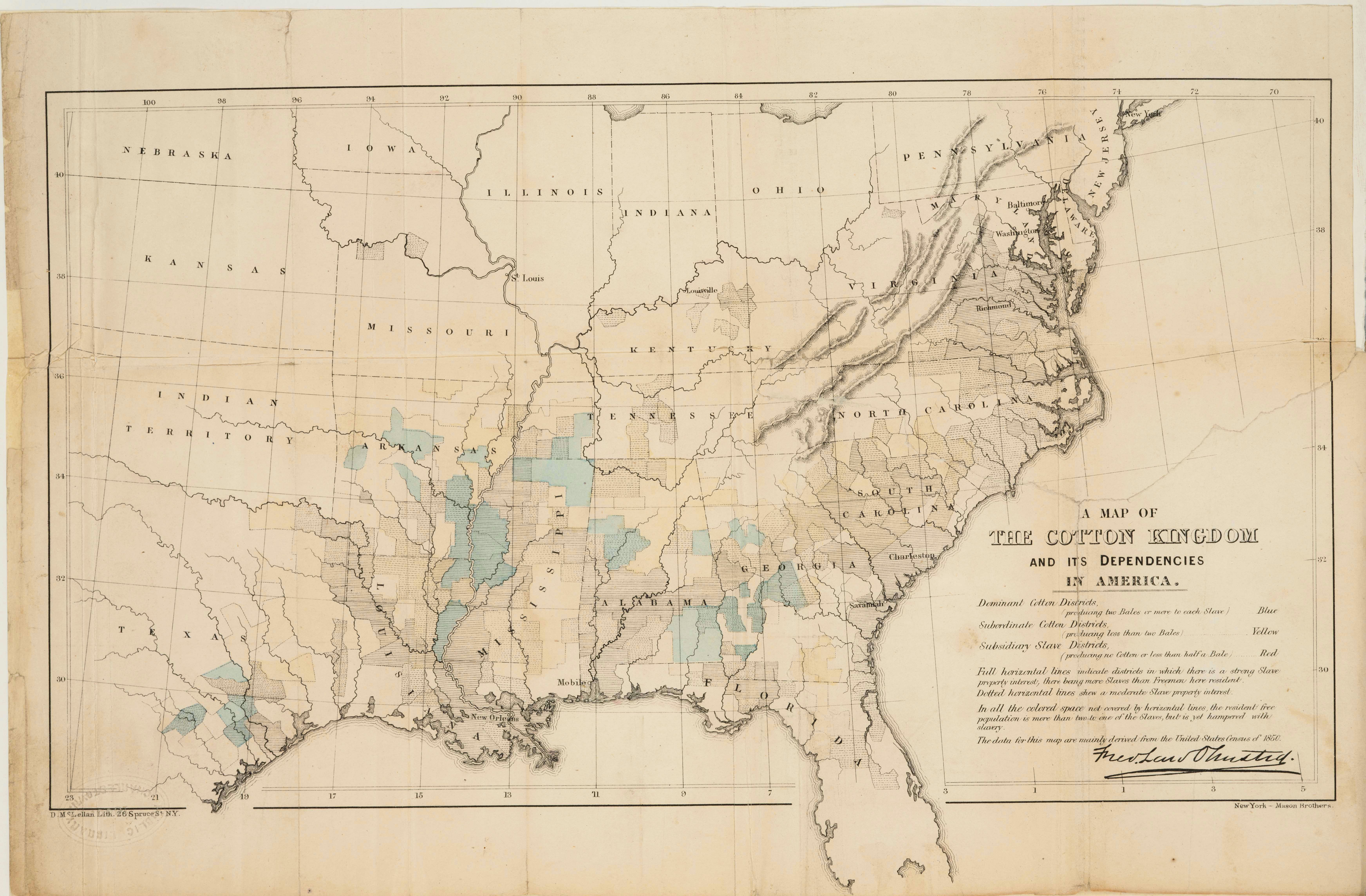
| Title | The Cotton Kingdom and its Dependencies
|
| Alternate Title | The Cotton Kingdom and its Dependencies
|
| Creator | Olmsted, Frederick Law, 1822-1903
|
| Type of Resource | cartographic
|
| Date Created | 1861
|
| Digital Origin | reformatted digital
|
| Topics | Slavery | Cotton growing
|
| Places | Southern States | United States
|
| Dates | Nineteenth century
|
| Subject Genre | Statistical maps
|
| Handle | http://hdl.handle.net/10176/codu:57054
|
| Rights Statement | Digitized by the Denver Public Library Western History Department. Made available by the University of Denver Penrose Library solely for research and educational purposes. The user is responsible for all copyright, privacy and publicity rights compliance.
|
| Language | English
|
| Extent | 1 online resource (map) : TIFF file, col.
|
| Physical Note | Raster | Original Sheet(s): 25 x 43 cm.
|
| Scale | Scale not given.
|
| Coordinates | (W 102°--W 70°/N 42°--N 28°)
|
| Notes | » Website description: Olmsted issued this map in the midst of the secession crisis to convince the British to withhold support for the Confederacy; it is the first attempt to measure cotton production on a map. | » Prime Meridians: Greenwich and Washington | » "The data for this map are mainly derived from the United States Census of 1850." | » Host/Source Creator: Olmsted, Frederick Law, 1822-1903. Host Type of Resource: text. Host Extent: lxiii, 626, xvi p. : facsim. ; 25 cm. Host Classification: F213 .O53 | » Alternate title from Website.
|
| Administrative Notes | Duplicate record. See PID: 58020.
|
| Local Identifiers | Olmsted_Map.tif | nationID: 4.13 | nationIDchrono: 3.01 | nationIDcreator: 1.61 | (OCoLC)59757835 | (DLC)rc 00002428 (Host) | (OCoLC)2574828 (Host) | (OCoLC)647053737 (Host) | (CARL)002574828 (Host)
|