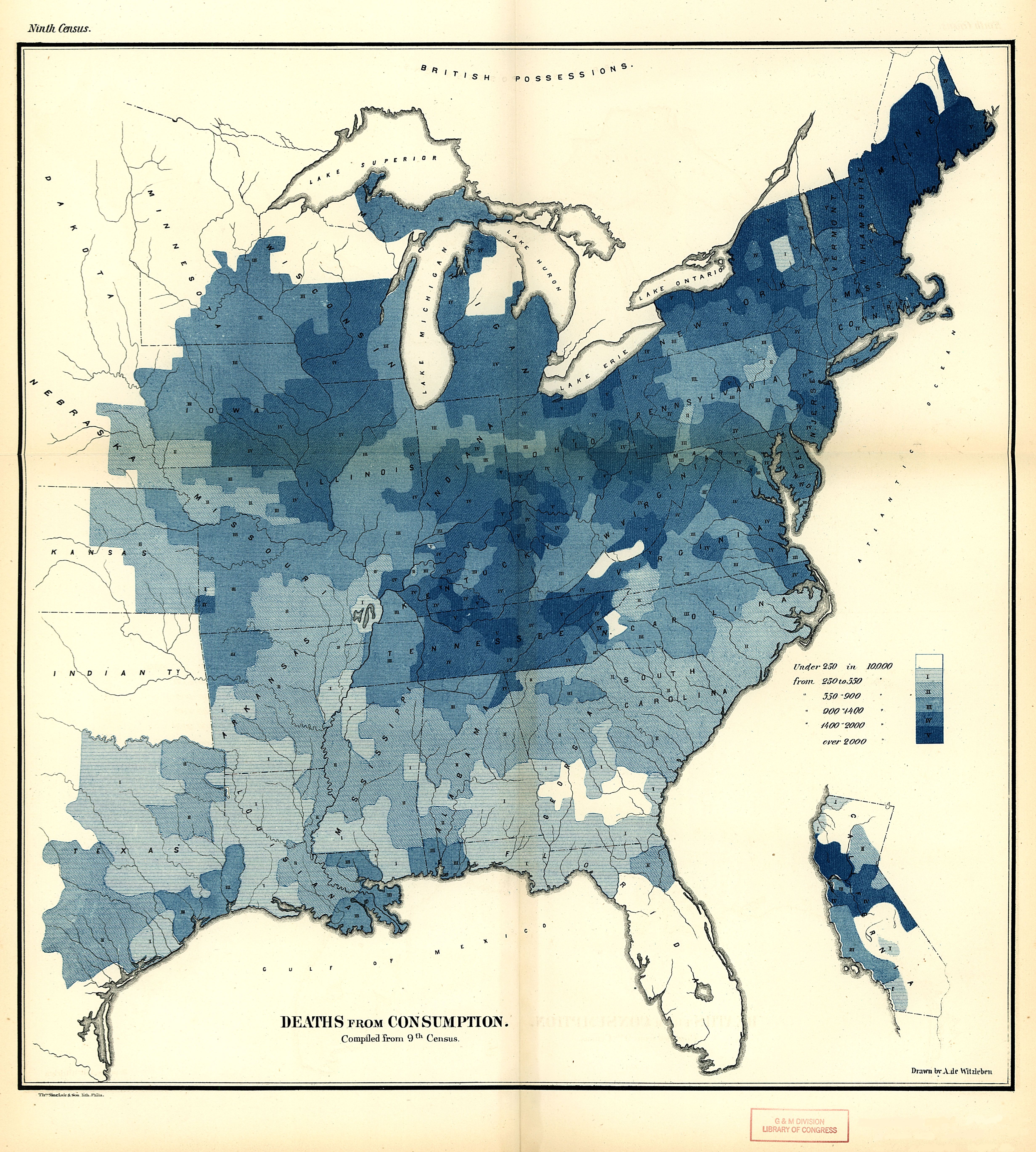
| Title | Map of the Distribution of Deaths from Consumption Compiled from the Ninth Census
|
| Alternate Title | Map of the Distribution of Deaths from Consumption Compiled from the Ninth Census
|
| Creator | Witzleben, Arthur de
|
| Type of Resource | cartographic
|
| Date Created | 1872
|
| Digital Origin | reformatted digital
|
| Topics | Tuberculosis | Mortality | Census
|
| Places | United States | East (U.S.)
|
| Dates | 1870
|
| Subject Genre | Statistical maps | Medical statistics | Vital statistics
|
| Handle | http://hdl.handle.net/10176/codu:57818
|
| Rights Statement | Digitized and made available by the University of Denver Penrose Library solely for research and educational purposes. The user is responsible for all copyright, privacy and publicity rights compliance.
|
| Language | English
|
| Extent | 1 online resource (map) : TIFF file, col.
|
| Physical Note | Raster | Original Sheet(s): 25 x 21 cm.
|
| Scale | Scale not given.
|
| Coordinates | (W 99°--W 67°/N 48°--N 25°)
|
| Notes | » Website description: This was one of Walker’s first attempts to map disease data, by measuring deaths from consumption against deaths in the total population. | » Census mapping of deaths per 10,000 population from this disease. | » In upper right outside the neat line: Ninth Census | » "Drawn by A. de Witzleben." | » "Thos. Sinclair & Son. lith. Phila."
|
| Local Identifiers | n1872_Consumption_Deaths.tif | nationID: 5.07.1 | nationIDchrono: 4.08.1 | nationIDcreator: 1.101 | (OCoLC)27462678 (Host)
|