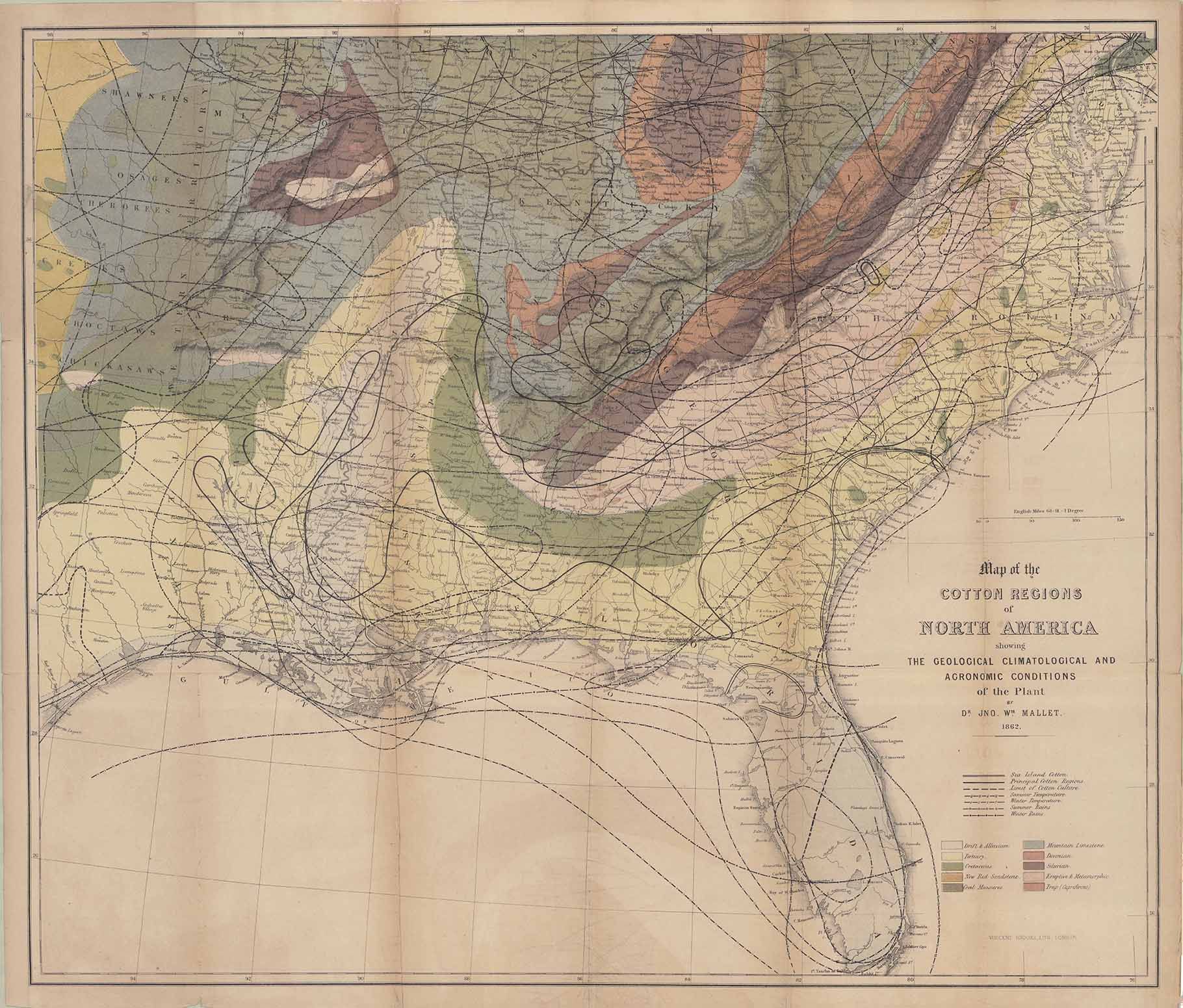
| Title | Map of the Cotton Regions of North America
|
| Alternate Title | Map of the Cotton Regions of North America
|
| Creator | Mallet, John William 1832-1912
|
| Type of Resource | cartographic
|
| Date Created | 1862
|
| Digital Origin | reformatted digital
|
| Topics | Cotton growing | Cotton manufacture
|
| Places | United States | Southern States
|
| Dates | Nineteenth century
|
| Subject Genre | Thematic maps
|
| Handle | http://hdl.handle.net/10176/codu:55700
|
| Rights Statement | Digitized and made available by the University of Denver Penrose Library solely for research and educational purposes. The user is responsible for all copyright, privacy and publicity rights compliance.
|
| Publisher | Chapman and Hall
|
| Language | English
|
| Extent | 1 online resource (map) : TIFF file, col.
|
| Physical Note | Raster | Original Sheet(s): 51 x 61 cm.
|
| Scale | Scale not given.
|
| Coordinates | (W 98°--W 75°/N 40°--N 25°)
|
| Notes | » Website description: Mallet designed this complex map to guide the British as they developed cotton in India, drawing on existing geological and environmental maps from the era. | » Scale bar in map image. | » Host/Source Creator: Mallet, John William 1832-1912. Host Type of Resource: text. Host Extent: xvi, 183, [1] p. col. front., fold. map, diagrs. 19 cm. | » Alternate title from Website.
|
| Local Identifiers | Mallet_Cotton_Map.tif | nationID: 4.14 | nationIDchrono: 3.10 | nationIDcreator: 1.56 | (DLC) 11033313 (Host) | (OCoLC)5432922 (Host)
|