
| First | Previous | Next | Last |
Hover over image to zoom • Click to open full size
Pinch to zoom • Double-tap to zoom • Drag to pan
| Title | Statistical Map of North America |
| Alternate Title | Statistical Map of North America |
| Type of Resource | cartographic |
| Date Created | 1841 |
| Digital Origin | reformatted digital |
| Topics | Population | Slavery |
| Places | North America | United States |
| Dates | Eighteen forty, A.D. |
| Subject Genre | Statistical maps |
| Handle | http://hdl.handle.net/10176/codu:55738 |
| Rights Statement | Digitized by the Denver Public Library Western History Department. Made available by the University of Denver Penrose Library solely for research and educational purposes. The user is responsible for all copyright, privacy and publicity rights compliance. |
| Publisher | J. & H.G. Langley |
| Language | English |
| Extent | 1 online resource (map) : TIFF file, col. |
| Physical Note | Raster | Original Sheet(s): 41 x 38 cm. |
| Scale | Scale not given. |
| Coordinates | (W 170°--W 50°/N 80°--N 15°) |
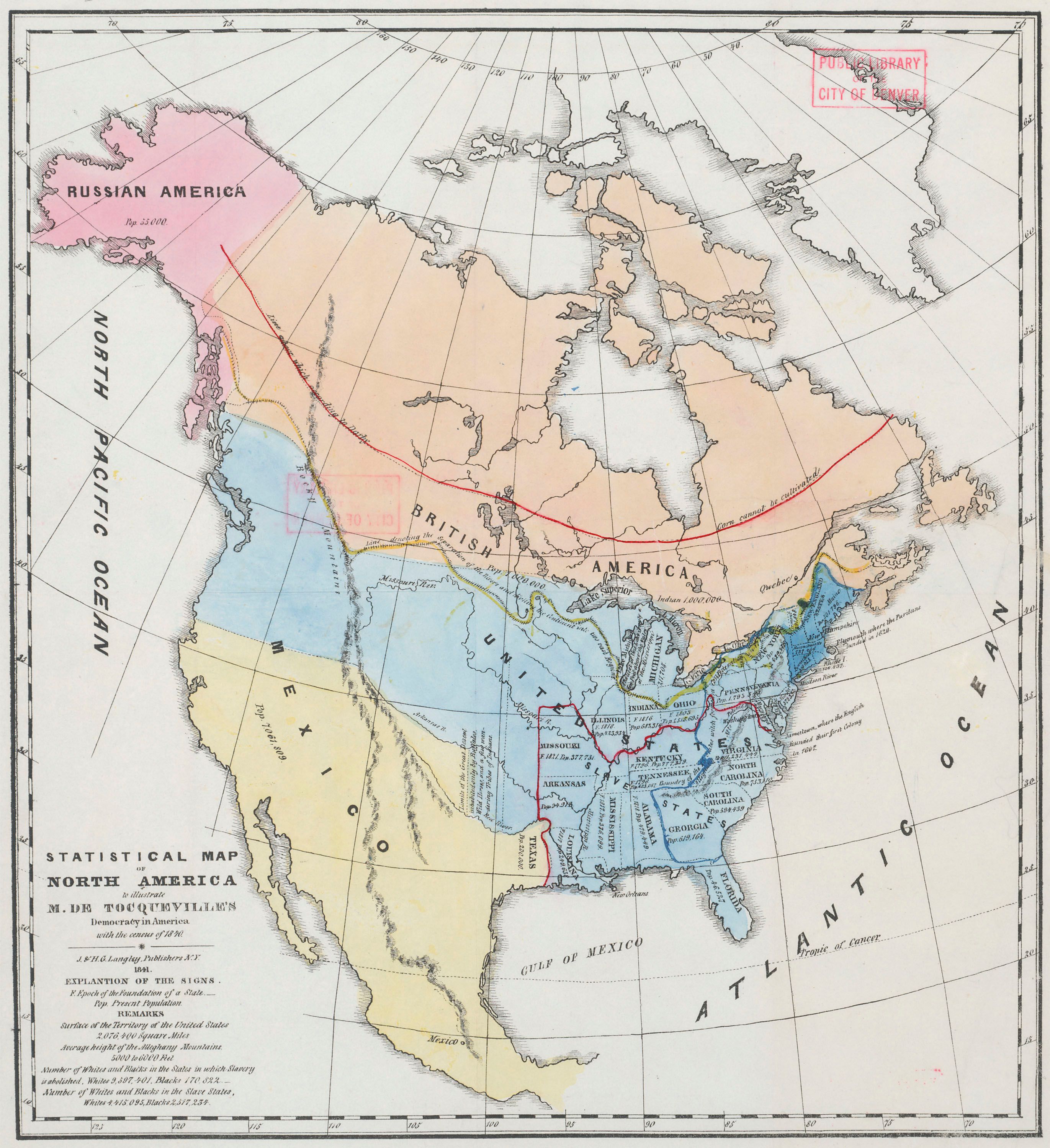
| Notes | » Website description: This is typical for its time: the title claims it as “statistical,” the data is simply listed on the map. Soon thereafter maps would begin to represent statistics through shading and other techniques. | » "Remarks: Surface of the Territory of the United States, 2,076,400 square miles, average height of the Alleghany Mountains, 5000 to 6000 feet. Number of Whites and Blacks in the states in which slavery is abolished, Whites 9,597,401, Blacks 170,822. Number of Whites and Blacks in slave states, Whites 4,415,095, Blacks 2,517,234." | » Includes population figures, 1840 census. | » Date of situation: 1840. | » Projection: Projection not given. | » Classification: 911.7 Classification Scheme: ddc. Classification: G1105 Classification Scheme: lcc. | » Host/Source Creator: Tocqueville, Alexis de, 1805-1859. Host/Source Contributor: Reeve, Henry, 1813-1895 ; Spencer, John C. (John Canfield), 1788-1855. Host Edition: 4th ed., rev. and corr. from the 8th Paris ed. Host Type of Resource: text. Host Form of Resource: monograph. Host Extent: 2 v. : folded map ; 22 cm. Host Classification: 342.73 Host Classification Scheme: ddc. | » Alternate title from Website. |
| Local Identifiers | Statistical_Map_NA.tif | nationID: 4.05 | nationIDchrono: 2.01 | nationIDcreator: 1.47.1 | (OCoLC)33597709 | (CARL)033597709 | (OCoLC)18554786 (Host) |
| Description | This is typical for its time: the title claims it as “statistical,” the data is simply listed on the map. Soon thereafter maps would begin to represent statistics through shading and other techniques. |