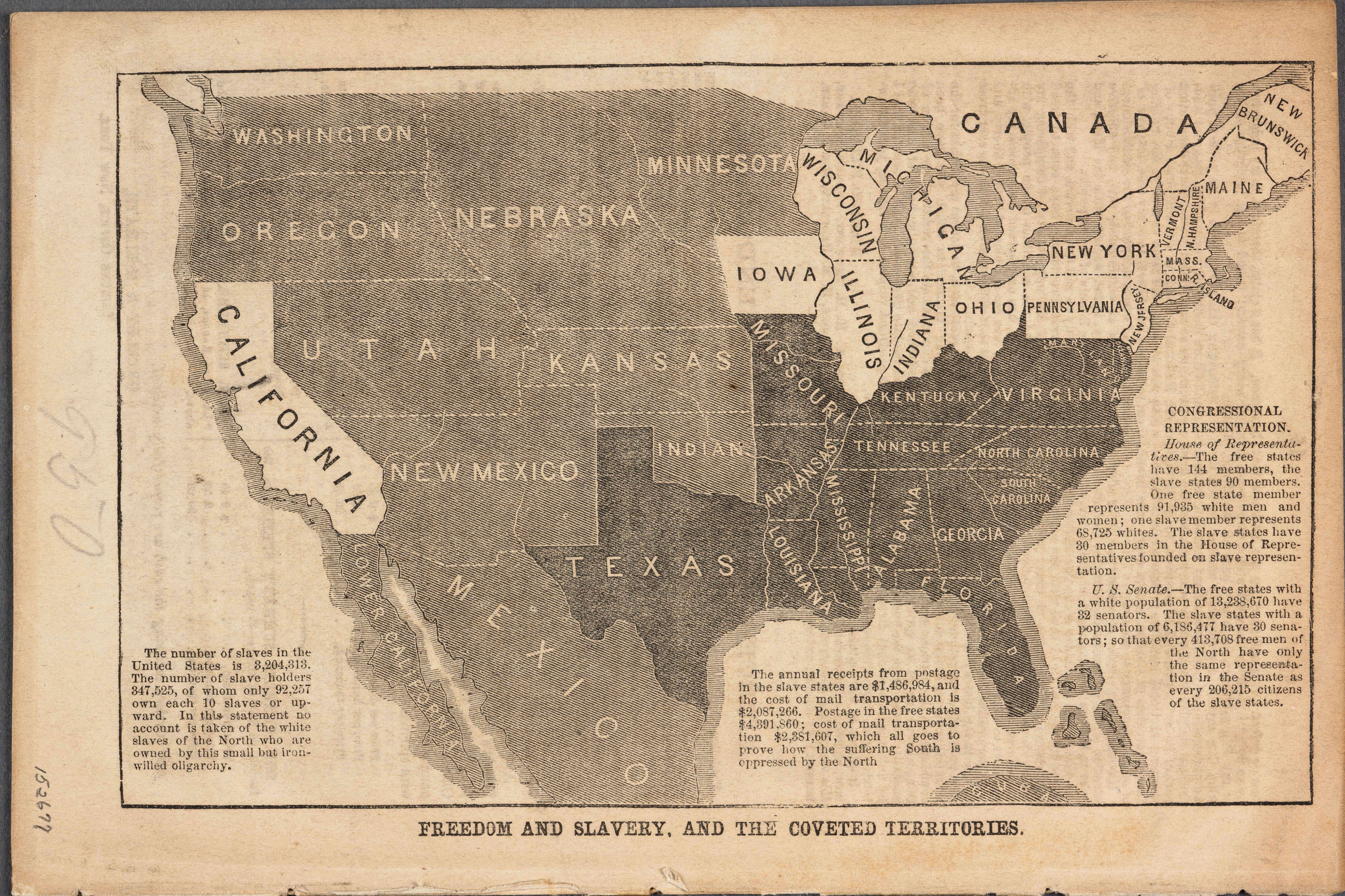
| Title | Freedom and Slavery, and the Coveted Territories
|
| Alternate Title | Freedom and Slavery, and the Coveted Territories
|
| Type of Resource | cartographic
|
| Date Created | 1856
|
| Digital Origin | reformatted digital
|
| Topics | Missouri compromise | Statehood (American Politics) | Slavery | Census
|
| Places | United States | Kansas
|
| Dates | Nineteenth century
|
| Subject Genre | Thematic maps | Campaign literature
|
| Handle | http://hdl.handle.net/10176/codu:57045
|
| Rights Statement | Digitized by the Huntington Library, Art Collections and Botanical Gardens. Mounted here by permission for scholarly, educational, artistic, cultural, or scientific purposes. The user is responsible for all copyright, privacy and publicity rights compliance.
|
| Publisher | Tribune Office
|
| Language | English
|
| Extent | 1 online resource (map) : TIFF file.
|
| Physical Note | Raster
|
| Scale | Scale not given.
|
| Coordinates | (W 130°--W 70°/N 50°--N 23°)
|
| Notes | » Website description: Anti-slavery activist John Jay used this map to alert northerners to the threat of slavery in the west, and to promote the cause of the newly-founded Republican Party in the 1856 presidential election. | » Host Type of Resource: text. Host Extent: 15, [1] p. : map ; 23 cm. Host Classification: 38896 Host Classification Scheme: The Huntington Library, Art Collections and Botanical Gardens call number. | » Alternate title from Website.
|
| Local Identifiers | Freedom_Slavery.tif | nationID: 4.04 | nationIDchrono: 2.17 | nationIDcreator: 1.113 | (DLC) 07034840 (Host) | (OCoLC)42386330 (Host) | (CSsH)38896 (Host)
|