| Title | Meteorology in its Connection with Agriculture
|
| Alternate Title | Meteorology in its Connection with Agriculture
|
| Creator | Henry, Joseph, 1797-1878
|
| Type of Resource | cartographic
|
| Date Created | 1856?
|
| Digital Origin | reformatted digital
|
| Topics | Winds | Land capability for agriculture | Land cover | Precipitation (Meteorology)
|
| Places | United States
|
| Dates | Nineteenth century
|
| Subject Genre | Thematic maps | Meteorological charts
|
| Handle | http://hdl.handle.net/10176/codu:55746
|
| Rights Statement | Digitized by the University of Denver Center for Teaching and Learning. Made available by the University of Denver Penrose Library solely for research and educational purposes. The user is responsible for all copyright, privacy and publicity rights compliance.
|
| Language | English
|
| Extent | 1 online resource (map) : TIFF file.
|
| Physical Note | Raster | Original Sheet(s): 11 x 16 cm.
|
| Scale | Scale not given.
|
| Coordinates | (W 125°--W 60°/N 50°--N 25°)
|
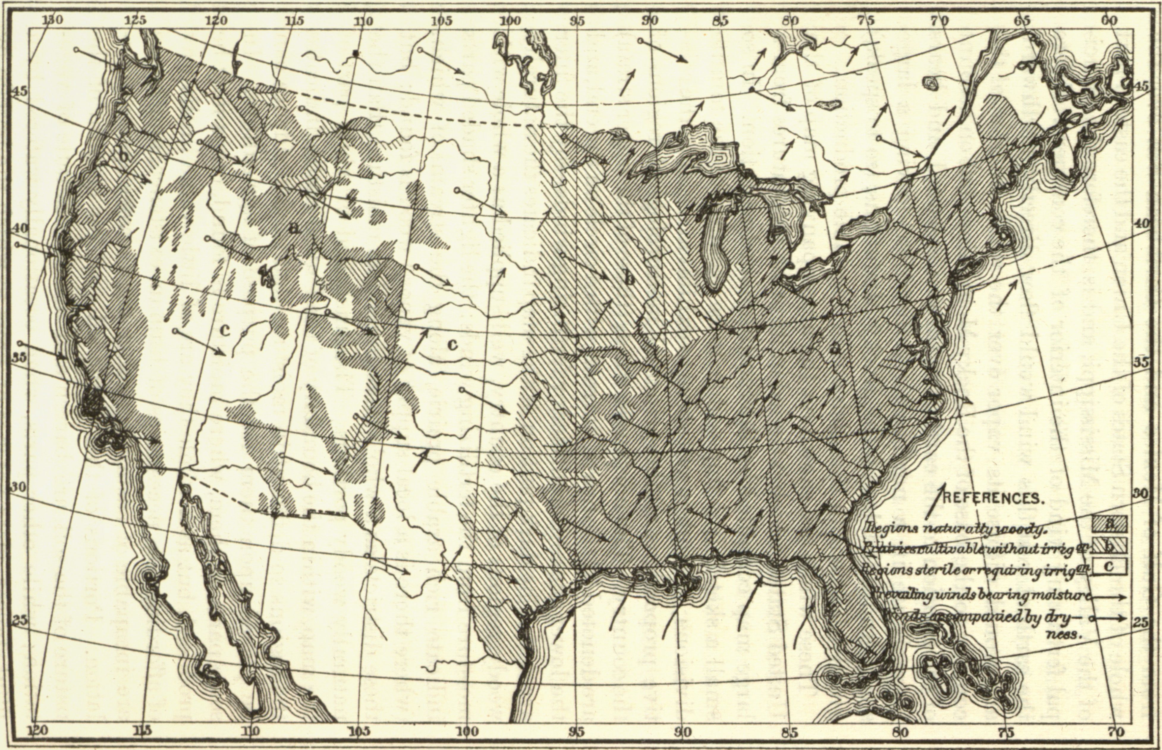
| Notes | » Website description: Notice that Joseph Henry uses this map to integrate several different aspects of the environment, including rainfall, woodland, and prevailing winds. | » Host/Source Creator: Henry, Joseph, 1797-1878. Host Type of Resource: text. Host Extent: 2 v. in 1 : illus., diagrs. ; 24 cm. | » Alternate title from Website.
|
| Local Identifiers | Henry_Prairie.tif | nationID: 3.16 | nationIDchrono: 2.18 | nationIDcreator: 1.34 | (DLC) 16006887 (Host) | (OCoLC)3245682 (Host)
|