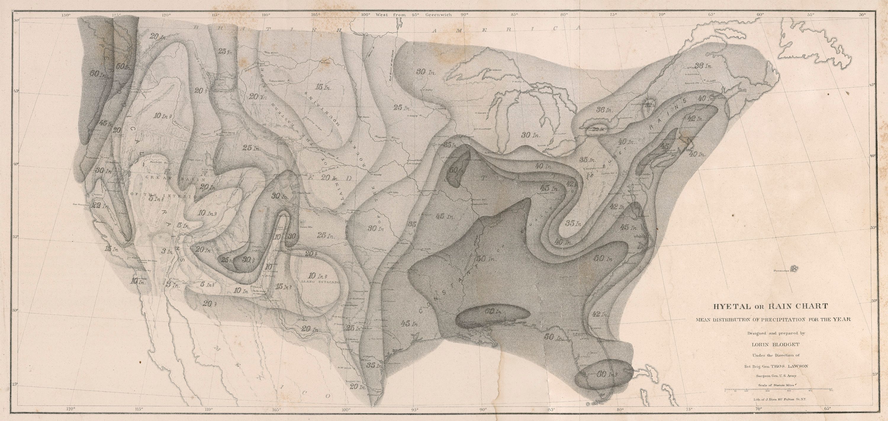
| Title | Map of Annual Rainfall
|
| Alternate Title | Map of Annual Rainfall
|
| Creator | Blodget, Lorin, 1823-1901
|
| Type of Resource | cartographic
|
| Date Created | 1855
|
| Digital Origin | reformatted digital
|
| Topics | Precipitation (Meteorology)
|
| Places | United States
|
| Dates | Nineteenth century
|
| Subject Genre | Thematic maps | Meteorological charts
|
| Handle | http://hdl.handle.net/10176/codu:55740
|
| Rights Statement | Digitized and made available by the University of Denver Penrose Library solely for research and educational purposes. The user is responsible for all copyright, privacy and publicity rights compliance.
|
| Publisher | A.O.P. Nicholson, Public Printer
|
| Language | English
|
| Extent | 1 online resource (map) : TIFF file.
|
| Physical Note | Raster | Original Sheet(s): 24 x 52 cm.
|
| Coordinates | (W 130°--W 50°/N 50°--N 25°)
|
| Notes | » Website description: Blodget published several maps of seasonal and annual rainfall, the result of decades of observations collected by the Smithsonian, the Army, and other federal agencies. | » Scale bar in map image. | » "Designed and Prepared by Lorin Blodget under the direction of Bvt Brig Gen. Thos. Lawson, Surgeon Gen. U.S. Army." | » Host/Source Creator: Blodget, Lorin, 1823-1901. Host/Source Contributor: Lawson, Thomas, 1781?-1861 ; Bien, Julius, 1826-1909. Host Type of Resource: text. Host Extent: 324 p. ; 23 cm. | » Alternate title from Website.
|
| Local Identifiers | Blodget_Hyetal_Rain.tif | nationID: 3.15 | nationIDchrono: 2.14 | nationIDcreator: 1.12 | (DLC) 03017384 (Host) | (OCoLC)2437890 (Host) | (OCoLC)758327548 (Host)
|