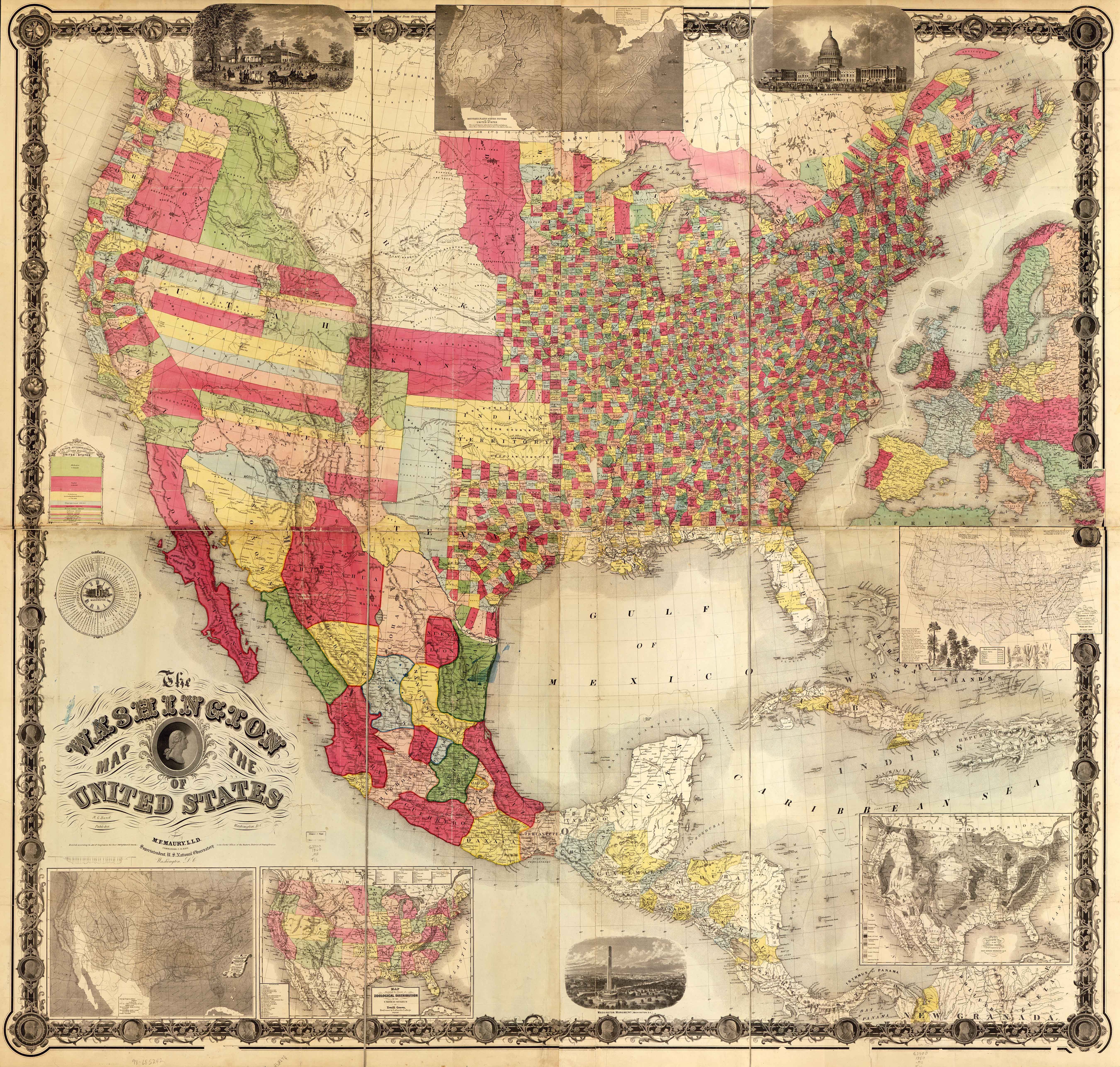
| Title | Washington Map of the United States
|
| Alternate Title | Washington Map of the United States
|
| Creator | Maury, Matthew Fontaine, 1806-1873
|
| Type of Resource | cartographic
|
| Date Created | 1860
|
| Digital Origin | reformatted digital
|
| Topics | Political geography
|
| Places | Canada | United States | Mexico
|
| Dates | Nineteenth century
|
| Subject Genre | Thematic maps
|
| Handle | http://hdl.handle.net/10176/codu:57071
|
| Rights Statement | The maps in the Map Collections materials were either published prior to 1922, produced by the United States government, or both (see catalogue records that accompany each map for information regarding date of publication and source). The Library of Congress is providing access to these materials for educational and research purposes and is not aware of any U.S. copyright protection (see Title 17 of the United States Code) or any other restrictions in the Map Collection materials. Note that the written permission of the copyright owners and/or other rights holders (such as publicity and/or privacy rights) is required for distribution, reproduction, or other use of protected items beyond that allowed by fair use or other statutory exemptions. Responsibility for making an independent legal assessment of an item and securing any necessary permissions ultimately rests with persons desiring to use the item.
|
| Publisher | H.G. Bond, Pub.
|
| Language | English
|
| Extent | 1 online resource (map) : TIFF file, col.
|
| Physical Note | Raster | Original Sheet(s): map 156 x 172 cm. on 2 sheets, each 78 x 172 cm.
|
| Scale | 1:3,294,720
|
| Coordinates | (W 129°--W 59°/N 50°--N 6°)
|
| Notes | » Website description: Maury compiled this massive wall map to showcase new thematic maps on the eve of the Civil War, which appear along the lower edge of the map. | » Relief shown in hachures and spot heights. | » Maps for an Emerging Nation, no. 55. | » Includes insets of 3 views, 4 maps and 1 cross section. | » Classification: G3700 1860 .M3 TIL | » Alternate title from Website.
|
| Local Identifiers | Washington_Map_of_the-United_States_1860.tif | nationID: 3.17 | nationIDchrono: 2.29 | nationIDcreator: 1.57 | (DLC) 98685242 | (OCoLC)430140096
|