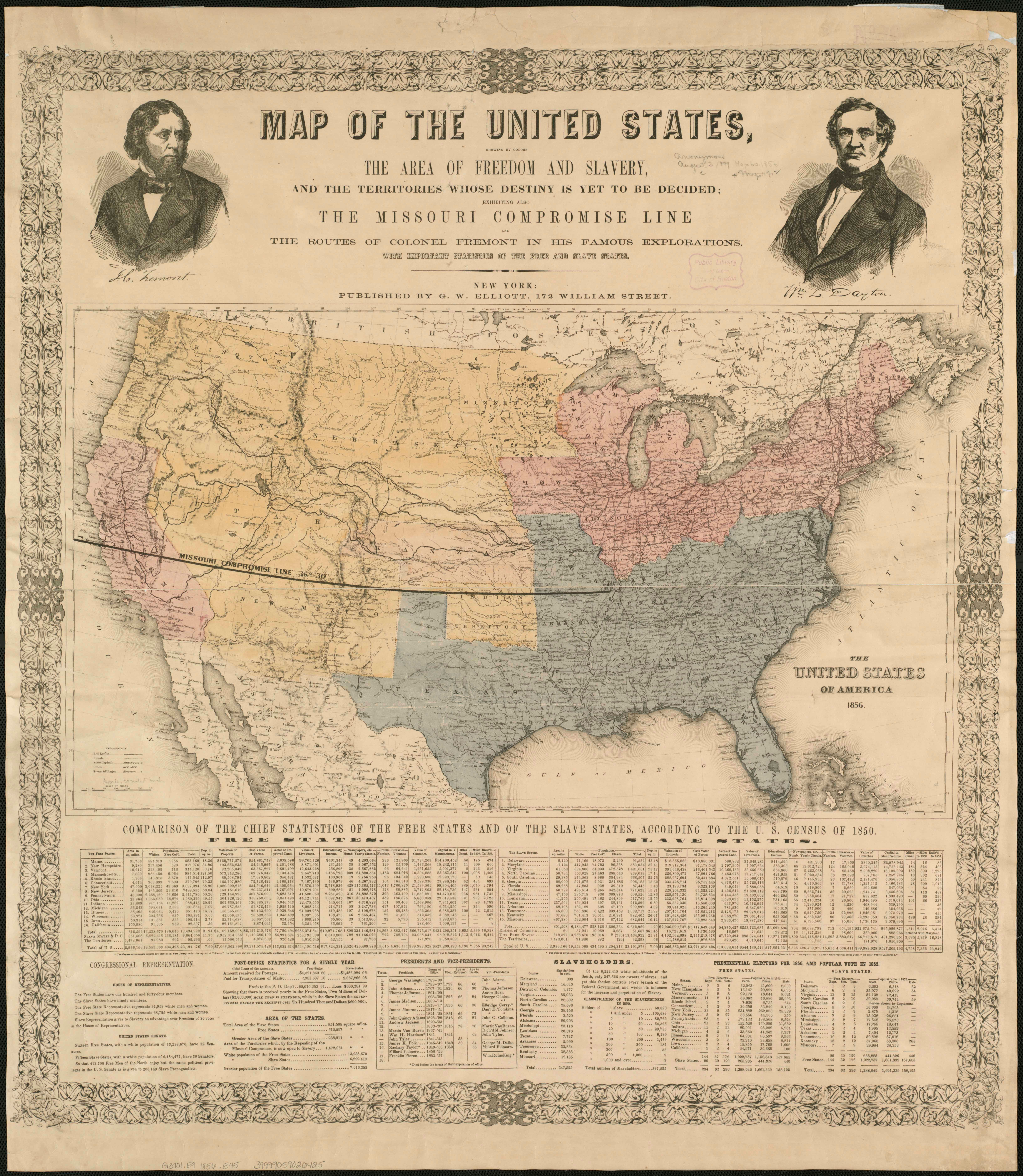
| Title | Map of the United States, Showing by Colors the Area of Freedom and Slavery
|
| Alternate Title | Map of the United States, Showing by Colors the Area of Freedom and Slavery
|
| Creator | Elliott, G. W.
|
| Type of Resource | cartographic
|
| Date Created | 1856
|
| Digital Origin | reformatted digital
|
| Topics | Slavery | Discoveries in geography | Voyages and travels | Missouri compromise | Presidential candidates | Elections | Census
|
| Places | United States
|
| Dates | Nineteenth century | 1856
|
| Subject Genre | Thematic maps
|
| Handle | http://hdl.handle.net/10176/codu:57049
|
| Rights Statement | Map Reproduction Courtesy of the Norman B. Leventhal Map Center at the Boston Public Library. Made available by the University of Denver Penrose Library solely for research and educational purposes. The user is responsible for all copyright, privacy and publicity rights compliance.
|
| Publisher | G.W. Elliott
|
| Language | English
|
| Extent | 1 online resource (map) : TIFF file, col.
|
| Physical Note | Raster | Original Sheet(s): 36 x 65 cm.
|
| Scale | 1:9,200,000
|
| Coordinates | (W 129°--W 63°/N 50°--N 24°)
|
| Notes | » Website description: One of many maps created for the 1856 election. The dark lines across the interior represent the expeditions of John Fremont, Republican candidate for president. | » Classification: G3701.E9 1856 .E45 | » Alternate title from Website.
|
| Local Identifiers | Map_Freedom_Slavery_1856.tif | nationID: 4.07 | nationIDchrono: 2.22 | nationIDcreator: 1.22 | (OCoLC)44142913 | (BRL) 3493794
|