| Title | Map of the Canals & Railroads of the United States
|
| Alternate Title | Map of the Canals & Railroads of the United States
|
| Creator | Tanner, Henry Schenck, 1786-1858
|
| Type of Resource | cartographic
|
| Date Created | 1832
|
| Digital Origin | reformatted digital
|
| Topics | Cholera
|
| Places | United States
|
| Dates | Nineteenth century | 1832
|
| Subject Genre | Statistical maps
|
| Handle | http://hdl.handle.net/10176/codu:58040
|
| Rights Statement | Digitized by the New York Academy of Medicine; made available by the University of Denver Penrose Library solely for research and educational purposes. The user is responsible for all copyright, privacy and publicity rights compliance.
|
| Publisher | Published by the author
|
| Language | English
|
| Extent | 1 online resource (map) : TIFF file, col.
|
| Physical Note | Raster | Original Sheet(s): map 43 x 58 cm. on sheet 47 x 60 cm.
|
| Scale | 1:7,000,000
|
| Coordinates | (W 105°--W 65°/N 50°--N 28°)
|
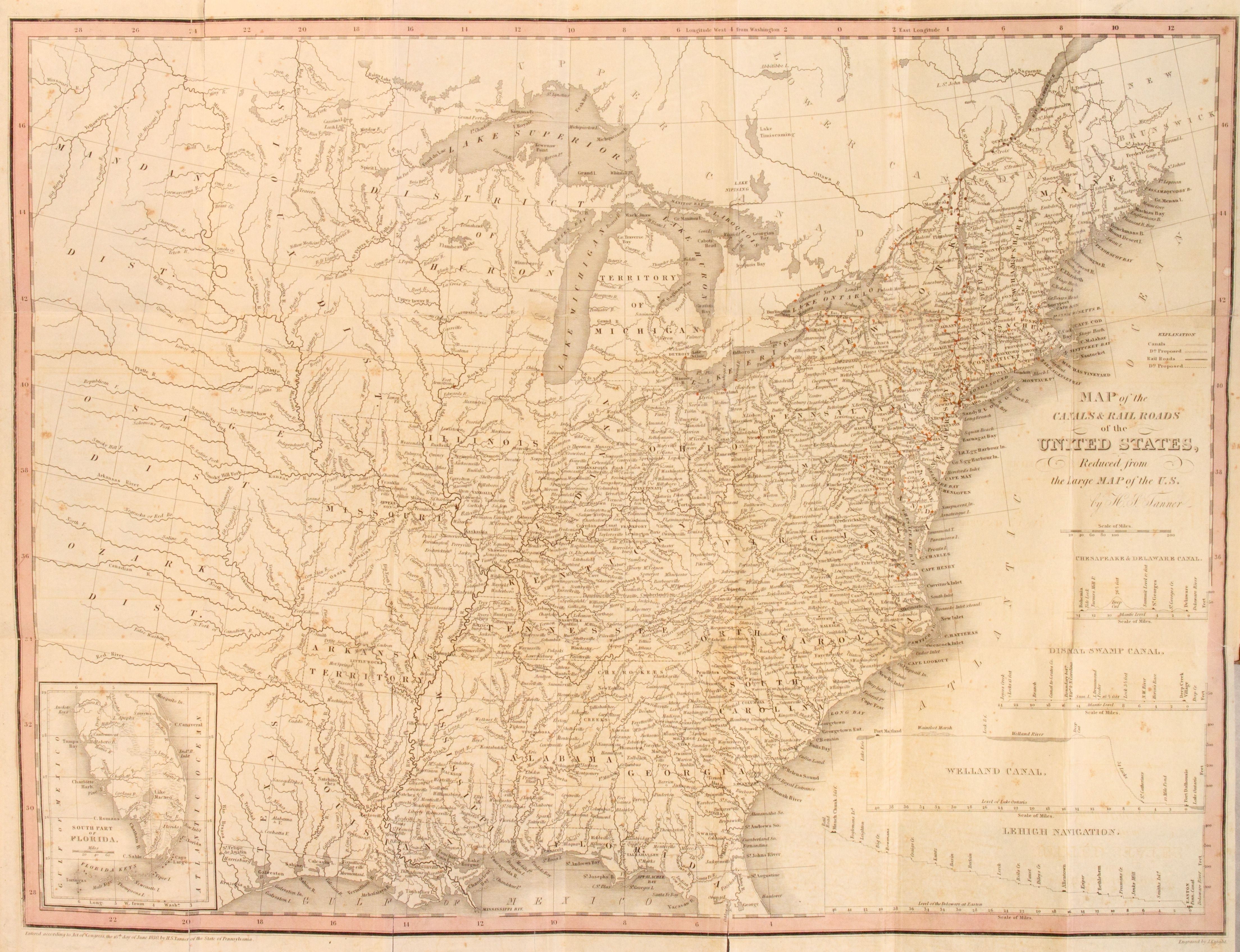
| Notes | » Website description: The Philadelphia mapmaker Henry Tanner adapted his existing map of the U.S. to trace the cholera epidemic of 1832. Notice his use of red ink to identify the cities of the outbreak. | » Prime meridian: Washington. | » "Engraved by J. Knight." | » Classification: G3701.P3 1830 .T3 ; RR 1 Classification Scheme: lcc ; Library of Congress Geography & Map Reading Room. | » Host/Source Creator: Tanner, H. S. (Henry Schenck), 1786-1858. Host Type of Resource: text. Host Extent: 35, [1] p., [3] leaves of plates : maps (col.) ; 19 cm. (12mo) Host Classification: RC126 .T35 Host Classification Scheme: lcc. | » Alternate title from Website.
|
| Local Identifiers | Tanner_US.tif | nationID: 3.05 | nationIDchrono: 1.13 | nationIDcreator: 1.79.1 | (DLC)gm 70005360 | (OCoLC)5496159 | (DLC) 35032076 (Host) | (OCoLC)14825625 (Host) | (NNNAM)114979 (Host)
|