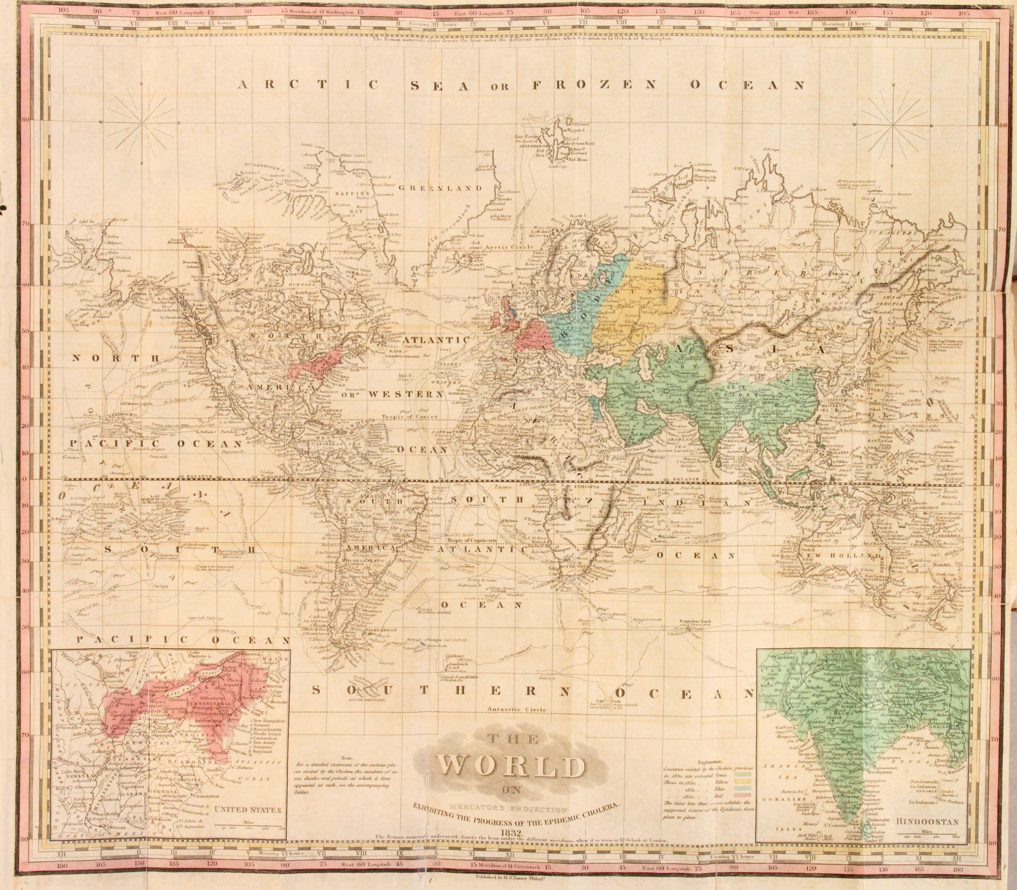
| Title | A Map of the World Exhibiting the Progress of Cholera
|
| Alternate Title | A Map of the World Exhibiting the Progress of Cholera
|
| Creator | Tanner, Henry Schenck, 1786-1858
|
| Type of Resource | cartographic
|
| Date Created | 1832
|
| Digital Origin | reformatted digital
|
| Topics | Epidemics | Cholera
|
| Places | World
|
| Dates | Nineteenth century
|
| Subject Genre | World maps
|
| Handle | http://hdl.handle.net/10176/codu:58041
|
| Rights Statement | Digitized by the New York Academy of Medicine, and made available by the University of Denver Penrose Library solely for research and educational purposes. The user is responsible for all copyright, privacy and publicity rights compliance.
|
| Language | English
|
| Extent | 1 online resource (map) : TIFF file, col.
|
| Physical Note | Raster | Original Sheet(s): 48 x 55 cm.
|
| Coordinates | (W 180°--E 180°/N 80°--S 80°)
|
| Notes | » Website description: Frustrated by what he considered the flawed and misleading maps of cholera, Henry Tanner designed this world map to identify the geographic and chronological phases of the epidemic. | » Scale bar in map image. | » Insets: United States, Hindoostan | » Projection: Transverse Mercator | » Prime meridians: Washington and Greenwich. | » Host/Source Creator: Tanner, H. S. (Henry Schenck), 1786-1858. Host Type of Resource: text. Host Extent: 35, [1] p., [3] leaves of plates : maps (col.) ; 19 cm. (12mo). Host Classification: RC126 .T35 1832 Host Classification Scheme: lcc. | » Alternate title from Website.
|
| Local Identifiers | Tanner_World.tif | nationID: 3.06 | nationIDchrono: 1.14 | nationIDcreator: 1.79 | (DLC) 35032076 (Host) | (OCoLC)14825625 (Host) | (NNNAM)114979 (Host)
|