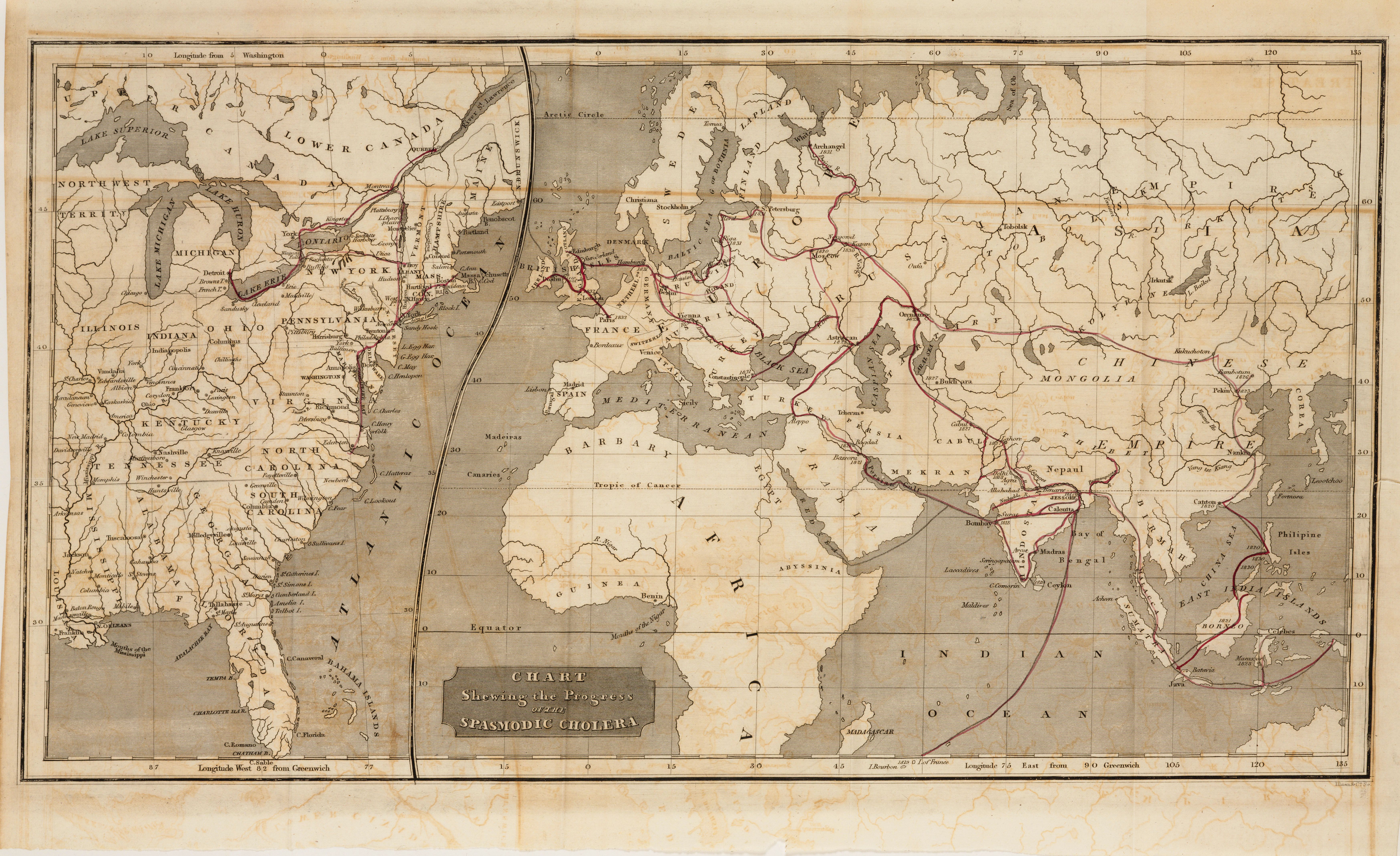
| Title | Chart Shewing the Progress of Spasmodic Cholera
|
| Alternate Title | Chart Showing the Progress of the Spasmodic Cholera | Chart Shewing the Progress of Spasmodic Cholera
|
| Creator | Brigham, Amariah, 1798-1849
|
| Type of Resource | cartographic
|
| Date Created | 1832
|
| Digital Origin | reformatted digital
|
| Topics | Cholera | Epidemics
|
| Places | Earth
|
| Dates | Nineteenth century
|
| Subject Genre | World maps
|
| Rights Statement | Digitized by the Huntington Library, Art Collections and Botanical Gardens. Mounted here by permission for scholarly, educational, artistic, cultural, or scientific purposes. The user is responsible for all copyright, privacy and publicity rights compliance.
|
| Publisher | H. and F. J. Huntington
|
| Language | English
|
| Extent | 1 online resource (map) : TIFF file, col.
|
| Physical Note | Raster | Original Sheet(s): 1 map : hand colored ; [23 x 43 cm.?]
|
| Scale | Scale not given.
|
| Coordinates | (W 20°--E 135°/N 70°--S 20°)
|
| Notes | » Website description: The international cholera epidemic of 1832 encouraged Brigham, and many others, to adopt maps to analyze the source and path of the disease. | » Prime meridian: Greenwich | » Includes inset of Lower Canada and the United States with prime meridian: Washington | » Host/Source Creator: Brigham, Amariah, 1798-1849. Host Type of Resource: text. Host Classification: 480057 Host Classification Scheme: The Huntington Library, Art Collections and Botanical Gardens call number. | » Last alternate title from Website.
|
| Local Identifiers | Brigham_Cholera.tif | nationID: 3.04 | nationIDchrono: 1.12 | nationIDcreator: 1.15 | (DLC) 07025191 (Host) | (OCoLC)13608891 (Host) | (CSsH)480057 (Host)
|