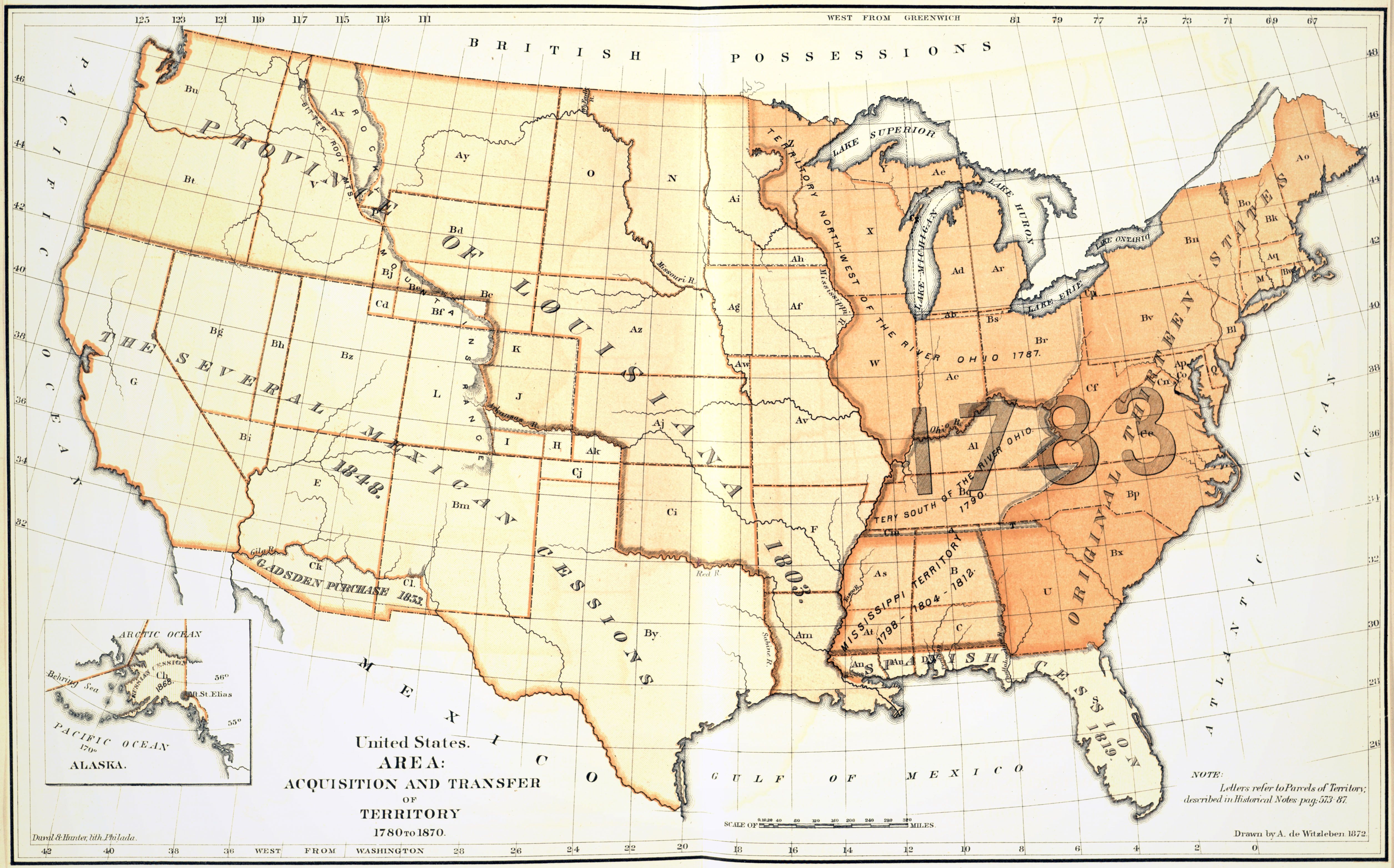
| Title | United States. Area: Acquisition and Transfer of Territory 1780 to 1870
|
| Alternate Title | United States. Area: Acquisition and Transfer of Territory 1780 to 1870
|
| Creator | Witzleben, Arthur de
|
| Type of Resource | cartographic
|
| Date Created | 1872
|
| Digital Origin | reformatted digital
|
| Topics | Historical geography | Census | Boundaries
|
| Places | United States
|
| Dates | Eighteenth century | Nineteenth century
|
| Subject Genre | Statistical maps
|
| Handle | http://hdl.handle.net/10176/codu:58029
|
| Rights Statement | Digitized and made available by the University of Denver Penrose Library solely for research and educational purposes. The user is responsible for all copyright, privacy and publicity rights compliance.
|
| Publisher | Government Printing Office
|
| Language | English
|
| Extent | 1 online resource (map) : TIFF file, col.
|
| Physical Note | Raster | Original Sheet(s): 26 x 41 cm.
|
| Scale | 1:11,404,800
|
| Coordinates | (W 125°--W 65°/N 49°--N 25°)
|
| Notes | » Website description: The abbreviations on this map refer to Francis Walker’s comprehensive narrative, which detailed the territorial growth of the nation, from the colonial era down to his own day. | » Ancillary map: Alaska | » "Note: Letters refer to parcels of territory, described in historical notes, pag. 573-87." | » Host/Source Creator: United States. Census Office. Host/Source Contributor: Walker, Francis A. (Francis Amasa), 1840-1897. Host Type of Resource: text. Host Extent: xlix, 804 p., [1] folded leaf of plates : map ; 30 cm. Host Classification: HA201 1870 .B2 | » Alternate title from Website.
|
| Local Identifiers | Ninth_Census_Area.tif | nationID: 5.09 | nationIDchrono: 4.09 | nationIDcreator: 1.103 | (OCoLC)613614619 | (OCoLC)27462678 (Host)
|