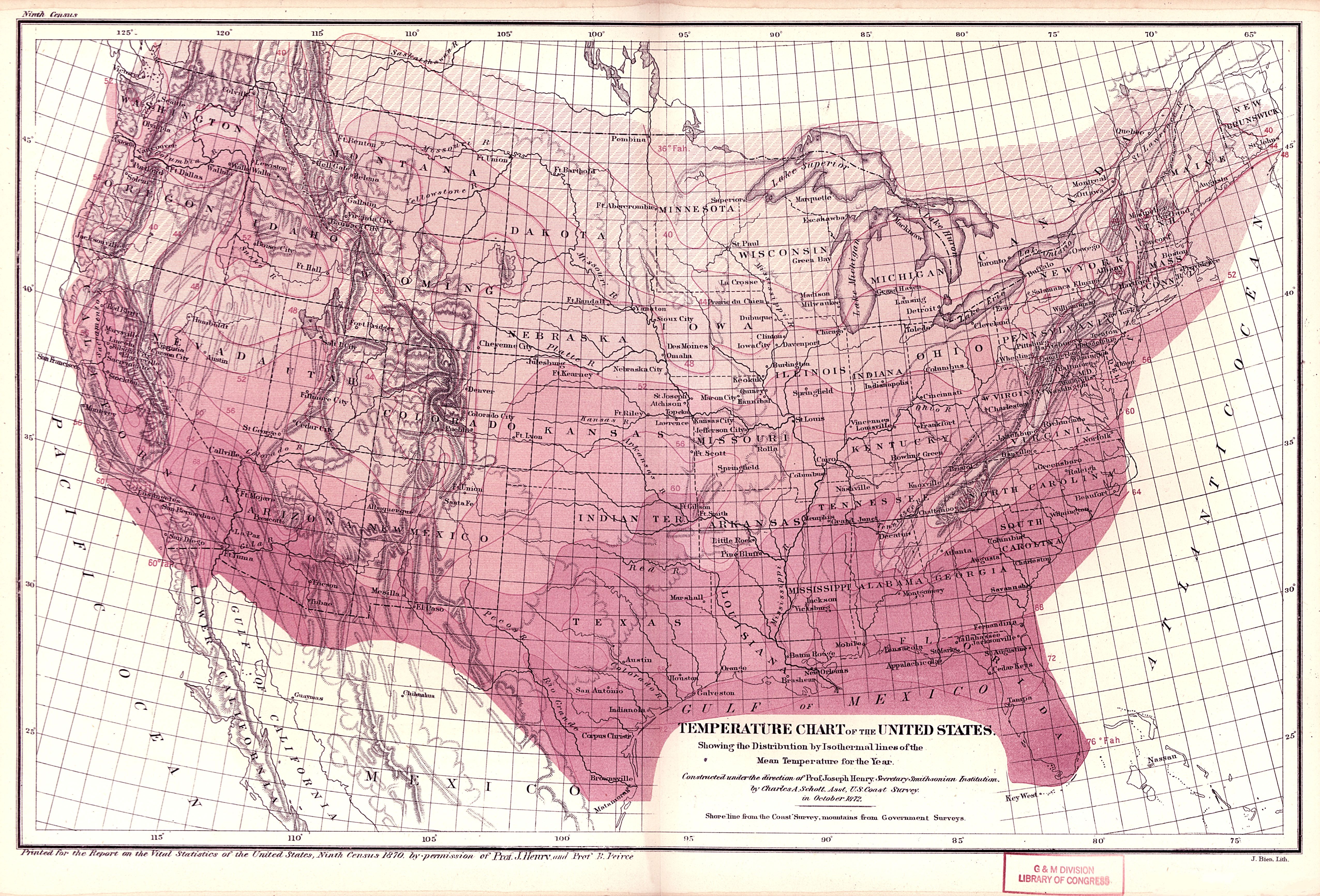
| Title | Temperature Chart of the United States
|
| Alternate Title | Temperature Chart of the United States
|
| Creator | Henry, Joseph, 1797-1878 | Schott, Charles A. (Charles Anthony), 1826-1901
|
| Type of Resource | cartographic
|
| Date Created | 1872
|
| Digital Origin | reformatted digital
|
| Topics | Meteorology
|
| Places | United States
|
| Dates | Nineteenth century
|
| Subject Genre | Statistical maps | Meteorological charts
|
| Handle | http://hdl.handle.net/10176/codu:57822
|
| Rights Statement | Digitized and made available by the University of Denver Penrose Library solely for research and educational purposes. The user is responsible for all copyright, privacy and publicity rights compliance.
|
| Publisher | Smithsonian Institution
|
| Language | English
|
| Extent | 1 online resource (map) : TIFF file, col.
|
| Physical Note | Raster | Original Sheet(s): 28 x 42 cm.
|
| Scale | Scale not given.
|
| Coordinates | (W 125°--W 65°/N 50°--N 24°)
|
| Notes | » Website description: With this and other physical maps, Census Superintendent Francis Walker revealed his interest in thinking about the population in the widest possible terms. | » Relief shown by hachures. | » "Shore line from the Coast Survey, mountains from Government surveys." | » "Printed for the Report on the Vital Statistics of the United States, Ninth Census 1870. by permission of Prof. J. Henry and Prof. B. Peirce" | » Host/Source Creator: United States. Census Office. Host/Source Contributor: Walker, Francis Amasa, 1840-1897. Host Type of Resource: text. Host Extent: xxiii, 679 p., [7] leaves of plates (some folded) : maps ; 30 cm. | » Alternate title from Website.
|
| Local Identifiers | n1872_Temperature_Chart.tif | nationID: 5.09.1 | nationIDchrono: 4.10 | nationIDcreator: 1.33 | (DLC) 78691504 | (OCoLC)557787627 | (OCoLC)27462678 (Host)
|