| Title | Map Showing the Proportion of the Foreign to the Aggregate Population
|
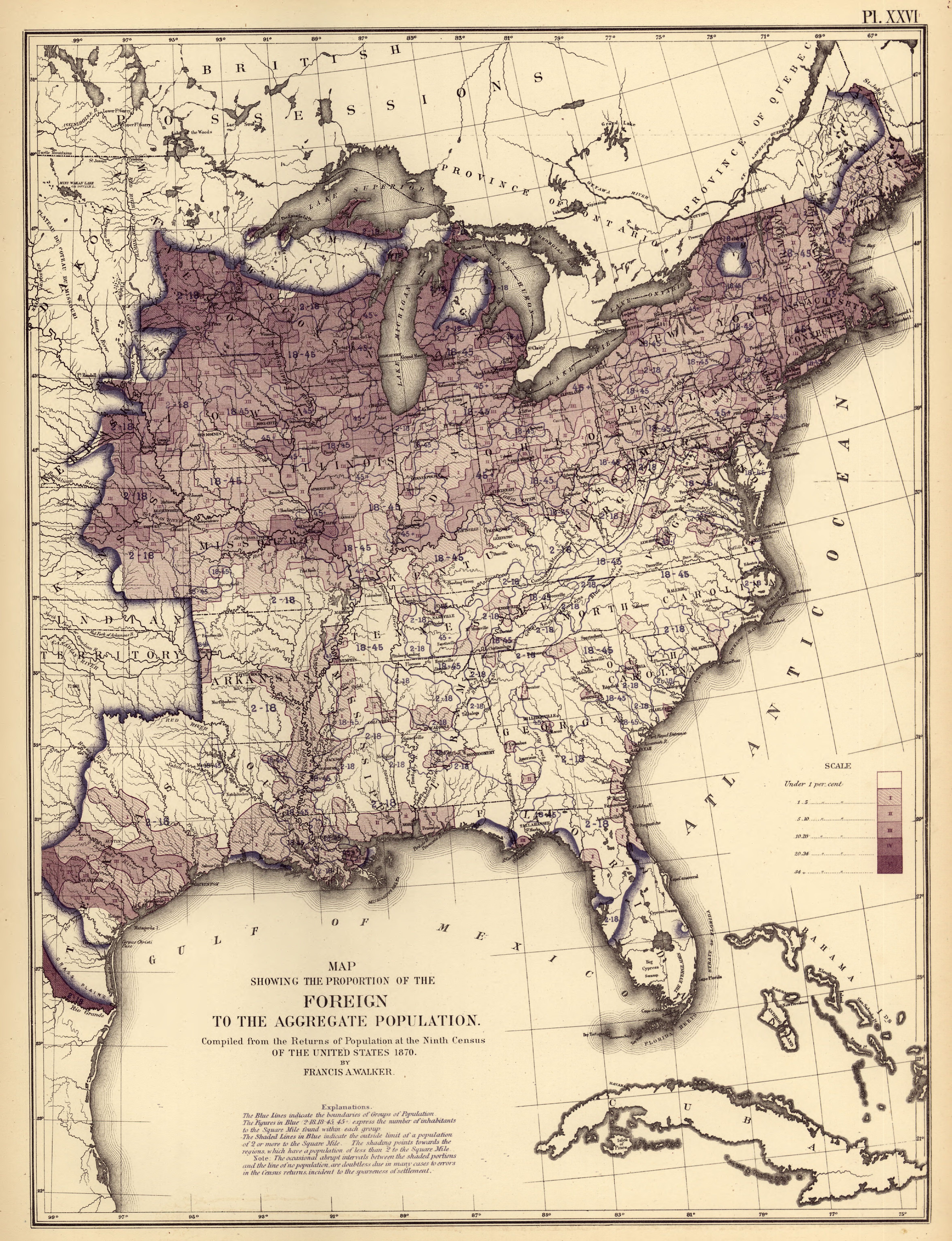
| Alternate Title | ...Compiled from the Returns of the Ninth Census of the United States. 1870. By Francis Amasa Walker | Proportion of the Foreign to the Aggregate Population | Map Showing the Proportion of the Foreign to the Aggregate Population
|
| Creator | Walker, Francis Amasa, 1840-1897
|
| Type of Resource | cartographic
|
| Date Created | 1874
|
| Digital Origin | reformatted digital
|
| Topics | Immigrants
|
| Places | United States
|
| Dates | 1870
|
| Subject Genre | Statistical maps
|
| Handle | http://hdl.handle.net/10176/codu:58036
|
| Rights Statement | Most maps in the Map Collections materials were either published prior to 1922, produced by the United States government, or both (see catalogue records that accompany each map for information regarding date of publication and source). A few have permission from the copyright holders as noted in the descriptive record. The Library of Congress is providing access to these materials for educational and research purposes and is not aware of any U.S. copyright protection (see Title 17 of the United States Code) or any other restrictions in the Map Collection materials. Note that the written permission of the copyright owners and/or other rights holders (such as publicity and/or privacy rights) is required for distribution, reproduction, or other use of protected items beyond that allowed by fair use or other statutory exemptions. Responsibility for making an independent legal assessment of an item and securing any necessary permissions ultimately rests with persons desiring to use the item.
|
| Language | English
|
| Extent | 1 online resource (map) : JP2 file, col.
|
| Physical Note | Raster | Original Sheet(s): 49 x 38 cm.
|
| Scale | 1:7,100,000
|
| Coordinates | (W 100°--W 66°/N 50°--N 24°)
|
| Notes | » Website description: Here Walker introduced Americans to a new kind of map that mapped information. Here population density is outlined in blue ink, while the foreign population is shaded in color. | » Host/Source Creator: United States. Census Office. Host/Source Contributor: Walker, Francis Amasa, 1840-1897 ; Bien, Julius, 1826-1909. Host Type of Resource: text. Host Extent: 1 p.l., 5 p., 1 l., 4, 14, 13, 8, 3, 4 p. : LIV pl. (maps, diagrs.) ; 56 x 24 cm. Host Classification: G1201.G1 U53 1874 Host Classification Scheme: lcc. | » Last alternate title from Website.
|
| Local Identifiers | Statistical_Foreign_Aggregate.jp2 | nationID: 5.12 | nationIDchrono: 4.14 | nationIDcreator: 1.82 | (OCoLC)62875088 | (CSfRHM)3566021 | (DLC) 05019329 (Host) | (OCoLC)2898344 (Host) | (OCoLC)62777866 (Host)
|