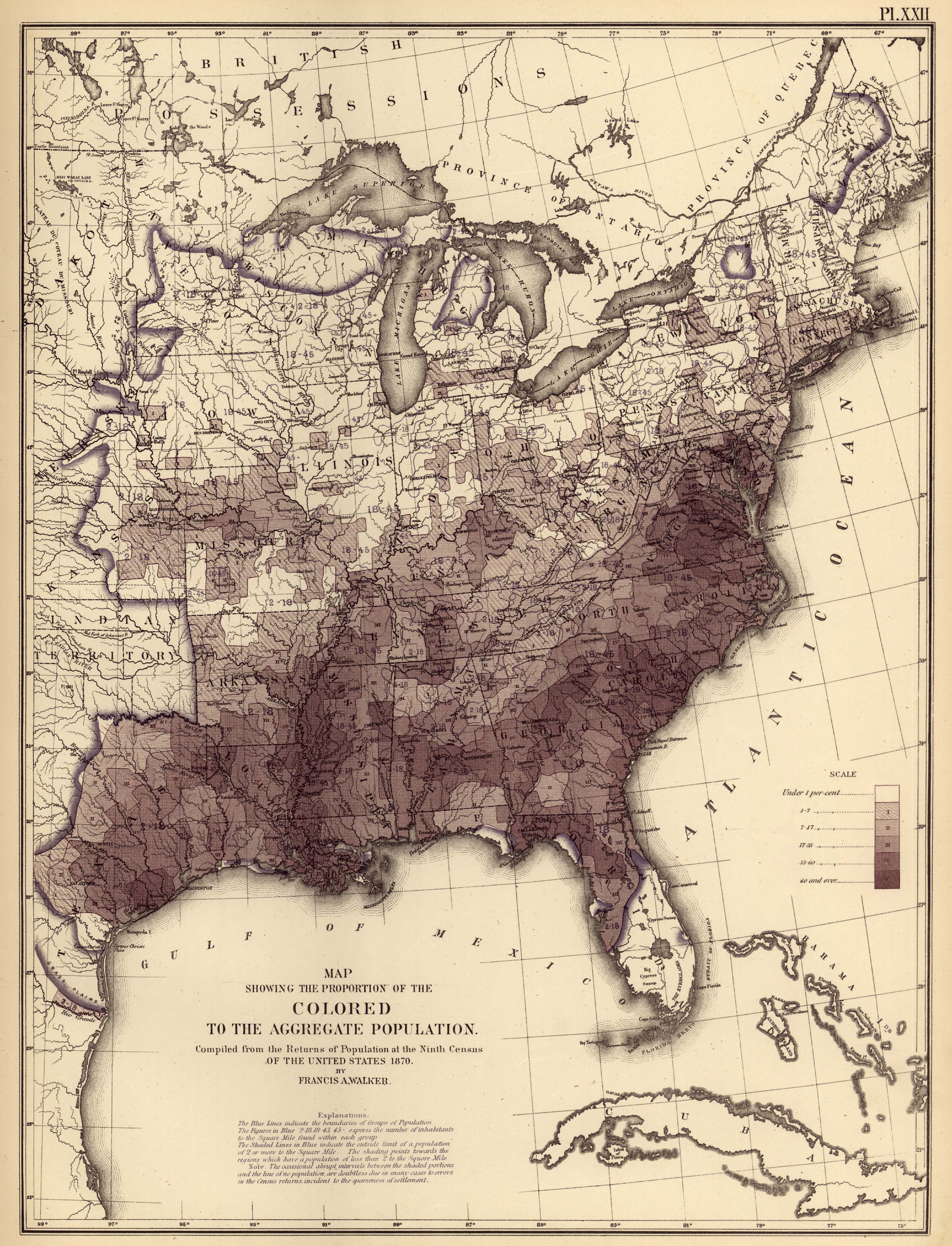
| Title | Map Showing the Proportion of the Colored to the Aggregate Population
|
| Alternate Title | Map Showing the Proportion of the Colored to the Aggregate Population
|
| Creator | Walker, Francis Amasa, 1840-1897
|
| Type of Resource | cartographic
|
| Date Created | 1870
|
| Digital Origin | reformatted digital
|
| Topics | African Americans
|
| Places | United States
|
| Dates | 1870
|
| Subject Genre | Statistical maps
|
| Handle | http://hdl.handle.net/10176/codu:57082
|
| Rights Statement | Scanned image Copyright 2005, Rumsey Collection (Cartography Associates), and used here under Creative Commons Attribution-NonCommercial-ShareAlike 2.0 Generic license.
|
| Publisher | J. Bien, lith.
|
| Language | English
|
| Extent | 1 online resource (map) : TIFF file, col.
|
| Physical Note | Raster | Original Sheet(s): 51 X 38 cm.
|
| Scale | 1:7,100,000
|
| Coordinates | (W 100°--W 66°/N 50°--N 24°)
|
| Notes | » Website description: Like the map of the foreign population above, this one was one of the first that enabled the viewer to think about the African American population in reference to the population as a whole. | » Host/Source Contributor: Walker, Francis Amasa, 1840-1897 ; Bien, Julius, 1826-1909. Host Type of Resource: text. Host Extent: 1 p.l., 5 p., 1 l., 4, 14, 13, 8, 3, 4 p. : LIV pl. (maps, diagrs.) ; 56 x 24 cm. | » Alternate title from Website.
|
| Local Identifiers | Statistical_Colored_Population.tif | nationID: 5.12.1 | nationIDchrono: 4.15 | nationIDcreator: 1.85 | (OCoLC)166642402 | (OCoLC)62875083 | (CSfRHM)3566019 | (DLC) 05019329 (Host) | (OCoLC)2898344 (Host) | (OCoLC)62777866 (Host)
|