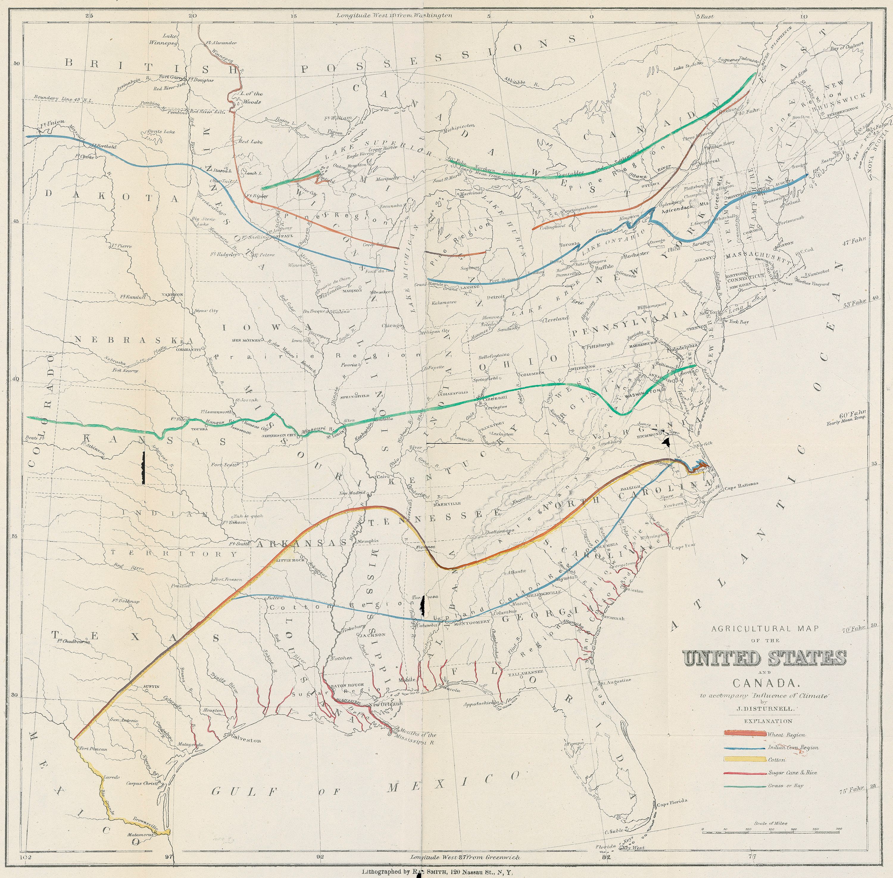
| Title | Agricultural Map of the United States and Canada
|
| Alternate Title | Agricultural Map of the United States and Canada
|
| Creator | Disturnell, John, 1808-1877
|
| Type of Resource | cartographic
|
| Date Created | 1867
|
| Digital Origin | reformatted digital
|
| Topics | Crop zones | Field Crops | Climate
|
| Places | North America | United States | Canada
|
| Dates | Nineteenth century
|
| Subject Genre | Thematic maps
|
| Handle | http://hdl.handle.net/10176/codu:57060
|
| Rights Statement | Digitized by the Denver Public Library Western History Department. Made available by the University of Denver Penrose Library solely for research and educational purposes. The user is responsible for all copyright, privacy and publicity rights compliance.
|
| Publisher | D. Van Nostrand
|
| Language | English
|
| Extent | 1 online resource (map) : TIFF file, col.
|
| Physical Note | Raster | Original Sheet(s): 35 x 35 cm.
|
| Scale | [ca. 1:8,448,000]
|
| Coordinates | (W 102°--W 70°/N 50°--N 25°)
|
| Notes | » Website description: By the 1860s mapping agriculture had become commonplace, and spread quickly in the twentieth century. | » Prime meridians: Washington and Greenwich. | » Hand col. to indicate regions primarily growing wheat, Indian corn, cotton, sugar cane & rice, grass or hay. | » Relief shown by hachures. | » Host Type of Resource: text. Host Extent: 334 p. : col. front., 2 fold. maps ; 24 cm. | » Alternate title from Website.
|
| Local Identifiers | Disturnell_Agriculture.tif | nationID: 3.24 | nationIDchrono: 3.18 | nationIDcreator: 1.20 | (OCoLC)664565648 | (DLC) 06023322 (Host) | (OCoLC)2959303 (Host) | (CARL)002959303 6 (Host)
|