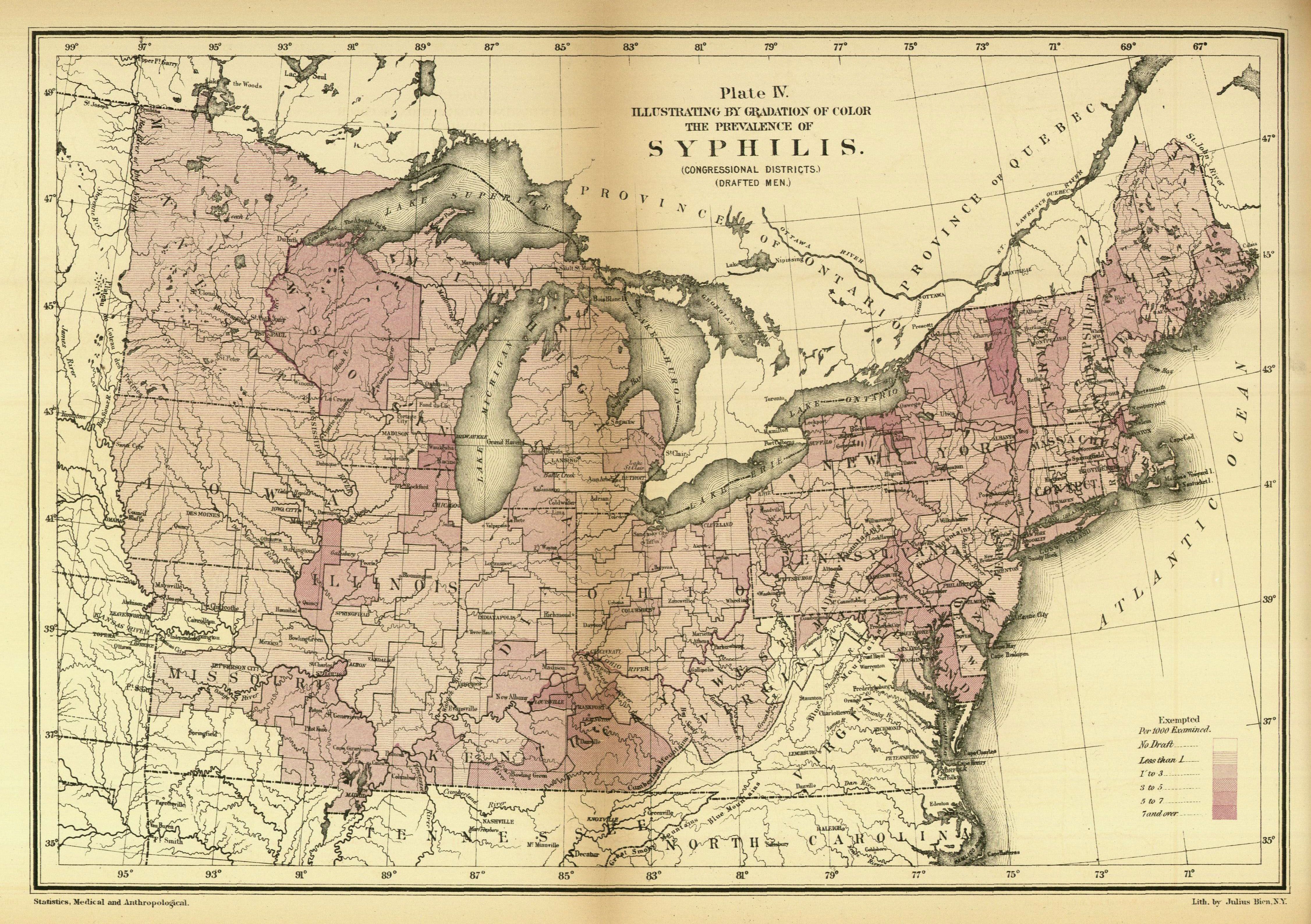
| Title | Plate IV. Illustrating by Gradation of Color the Prevalence of Syphilis
|
| Alternate Title | Plate IV. Illustrating by Gradation of Color the Prevalence of Syphilis
|
| Creator | Baxter, J. H. (Jedediah H.)
|
| Type of Resource | cartographic
|
| Date Created | 1875
|
| Digital Origin | reformatted digital
|
| Topics | Syphilis | Draftees | Medical geography | Epidemiology
|
| Places | East (U.S.)
|
| Dates | Nineteenth century
|
| Subject Genre | Statistical maps | Medical statistics
|
| Handle | http://hdl.handle.net/10176/codu:57066
|
| Rights Statement | Digitized and made available by the University of Denver Penrose Library solely for research and educational purposes. The user is responsible for all copyright, privacy and publicity rights compliance.
|
| Language | English
|
| Extent | 1 online resource (map) : TIFF file, col.
|
| Physical Note | Raster | Original Sheet(s): 30 x 42 cm.
|
| Scale | Scale not given.
|
| Coordinates | (W 99°--W 67°/N 47°--N 35°)
|
| Notes | » Website description: The Army collected extensive data regarding the health of Union soldiers during the Civil War, and thereafter Congress funded the effort to translate this information into cartographic form. | » Host/Source Creator: United States. Provost Marshal General's Bureau. Host/Source Contributor: Baxter, J. H., (Jedediah H.). Host Classification: UH223 .A4 1861/5 Host Classification Scheme: lcc. | » Alternate title from Website.
|
| Local Identifiers | PMG_Syphilis_Map.tif | nationID: 5.19 | nationIDchrono: 4.27 | nationIDcreator: 1.80.3 | (DLC) 06044831 (Host) | (OCoLC)1968189 (Host)
|