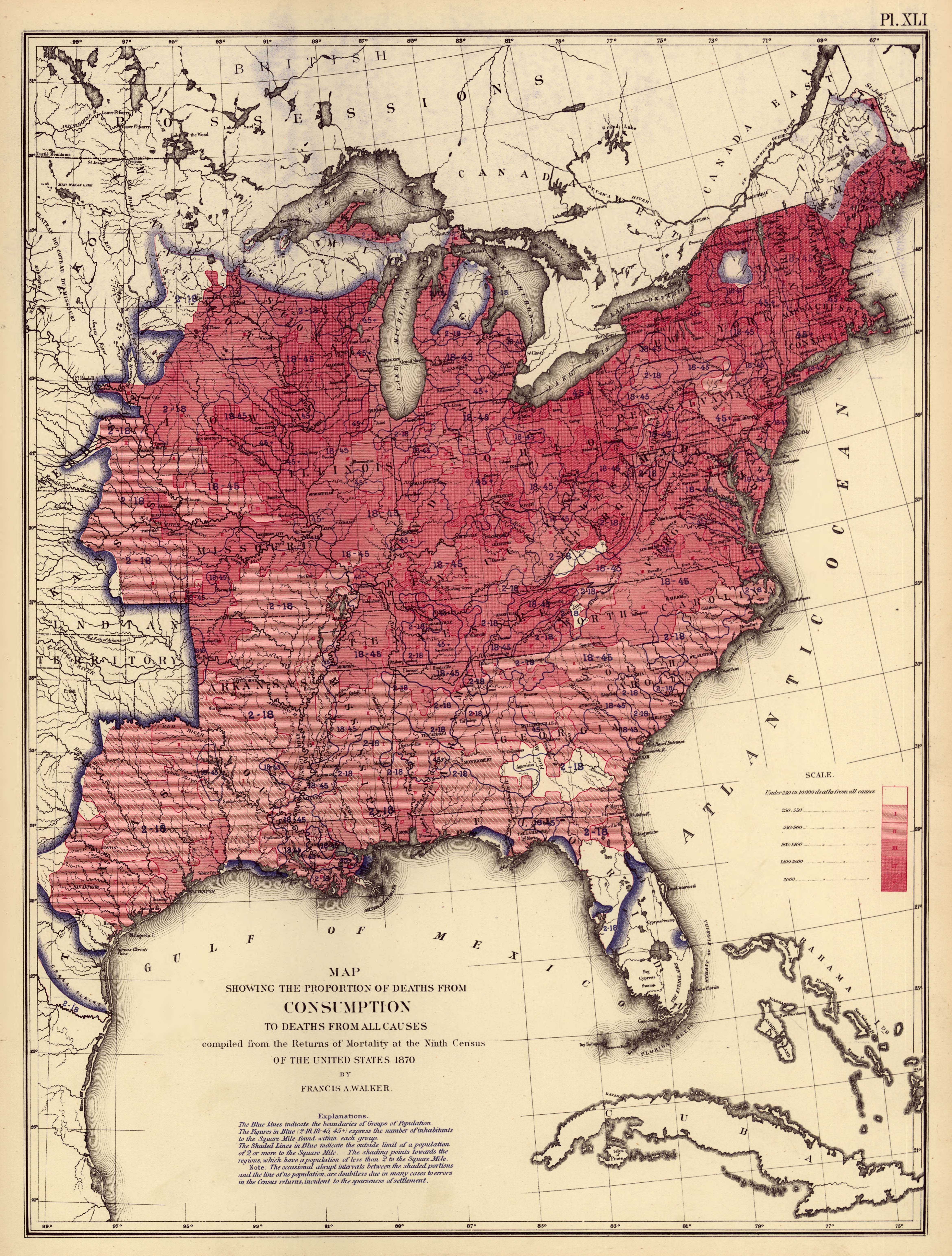
| Title | Map Showing the Proportion of Deaths from Consumption to Deaths from All Causes
|
| Alternate Title | Map Showing the Proportion of Deaths from Consumption to Deaths from All Causes
|
| Creator | Walker, Francis Amasa, 1840-1897
|
| Type of Resource | cartographic
|
| Date Created | 1870
|
| Digital Origin | reformatted digital
|
| Topics | Tuberculosis | Mortality | Vital statistics
|
| Places | United States
|
| Dates | 1870
|
| Subject Genre | Statistical maps
|
| Handle | http://hdl.handle.net/10176/codu:57077
|
| Rights Statement | Scanned image Copyright 2005, Rumsey Collection (Cartography Associates), and used here under Creative Commons Attribution-NonCommercial-ShareAlike 2.0 Generic license.
|
| Language | English
|
| Extent | 1 online resource (map) : TIFF file, col.
|
| Physical Note | Raster | Original sheet(s): 49 x 38 cm.
|
| Scale | 1:7,200,000
|
| Coordinates | W 99°--W 67°/N 51°--N 21°
|
| Notes | » Website description: Walker chose several categories to map, including the incidence of different diseases and their relative effect on death rates. | » Host/Source Creator: United States. Census Office. Host/Source Contributor: Walker, Francis Amasa, 1840-1897 ; Bien, Julius, 1826-1909. Host Type of Resource: text. Host Extent: 1 p.l., 5 p., 1 l., 4, 14, 13, 8, 3, 4 p. : LIV pl. (maps, diagrs.) ; 56 x 24 cm. | » Alternate title from Website.
|
| Local Identifiers | Statistical_Consumption_Map.tif | nationID: 5.14 | nationIDchrono: 4.18 | nationIDcreator: 1.89 | (OCoLC)62944673 | (CSfRHM)3566041 | (DLC) 05019329 (Host) | (OCoLC)2898344 (Host) | (OCoLC)62777866 (Host)
|