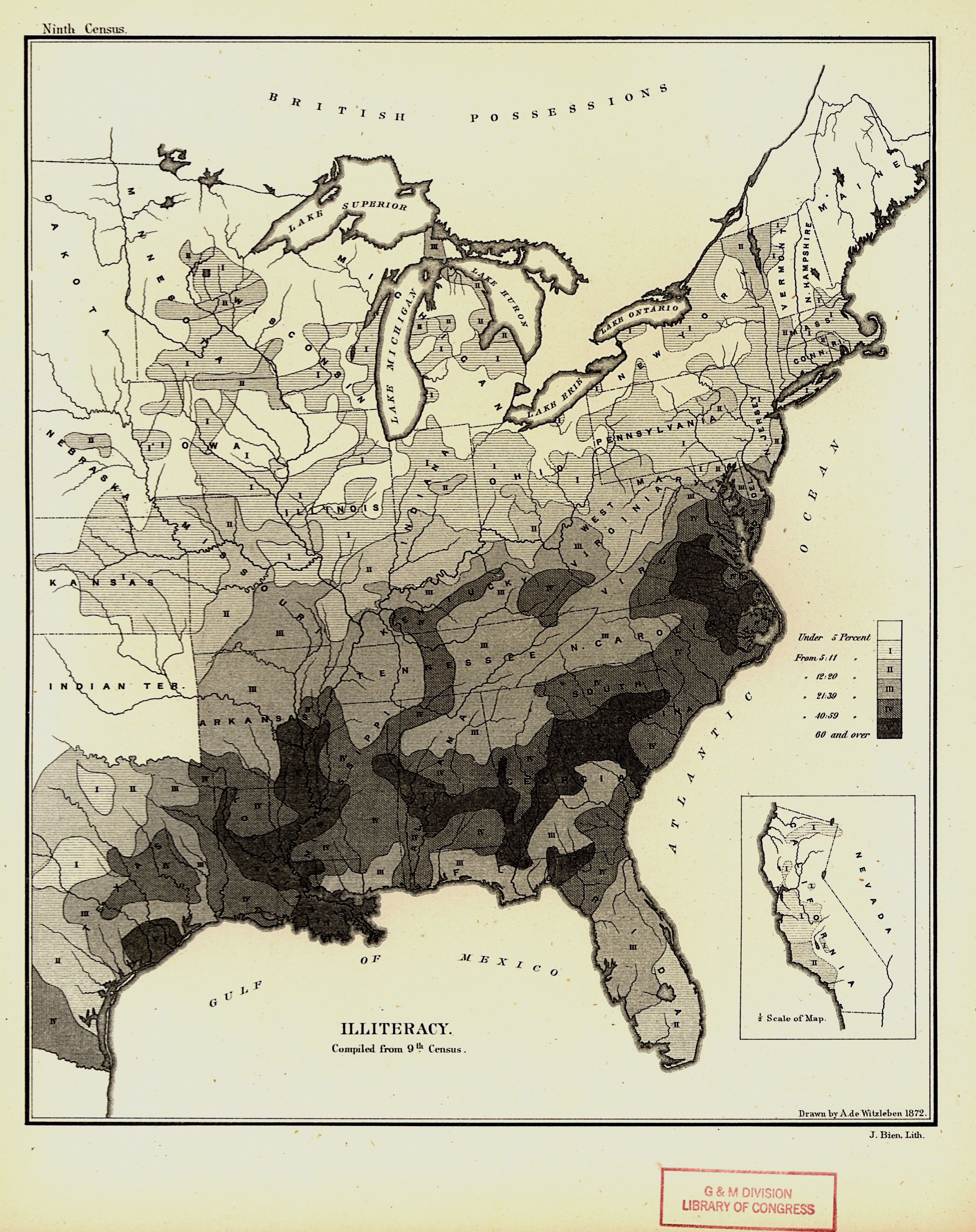
| Title | Map of the Distribution of Illiteracy Compiled from the Ninth Census
|
| Alternate Title | Map of the Distribution of Illiteracy Compiled from the Ninth Census
|
| Creator | Witzleben, Arthur de
|
| Type of Resource | cartographic
|
| Date Created | 1872
|
| Digital Origin | reformatted digital
|
| Topics | Literacy | Population | Census
|
| Places | United States | East (U.S)
|
| Dates | 1870
|
| Subject Genre | Statistical maps
|
| Handle | http://hdl.handle.net/10176/codu:57813
|
| Rights Statement | Digitized and made available by the University of Denver Penrose Library solely for research and educational purposes. The user is responsible for all copyright, privacy and publicity rights compliance.
|
| Publisher | United States. Government Printing Office
|
| Language | English
|
| Extent | 1 online resource (map) : TIFF file.
|
| Physical Note | Raster | Original Sheet(s): 25 x 21 cm.
|
| Scale | Scale not given.
|
| Coordinates | (W 99°--W 67°/N 49°--N 25°)
|
| Notes | » Website description: Walker applied the new thematic mapping techniques from Europe to every aspect of American life that he could quantify, including disease, wealth, literacy, and ethnicity. | » In upper left margin: Ninth census. | » In lower right margin: J. Bien, Lith. | » Includes index to illiterate populations in the eastern United States in 1870. | » Ancillary map: California. | » Alternate title from Website.
|
| Local Identifiers | n1872_Illiteracy.tif | nationID: 5.07 | nationIDchrono: 4.07 | nationIDcreator: 1.106 | (OCoLC)613636136 | (OCoLC)27462678 (Host)
|