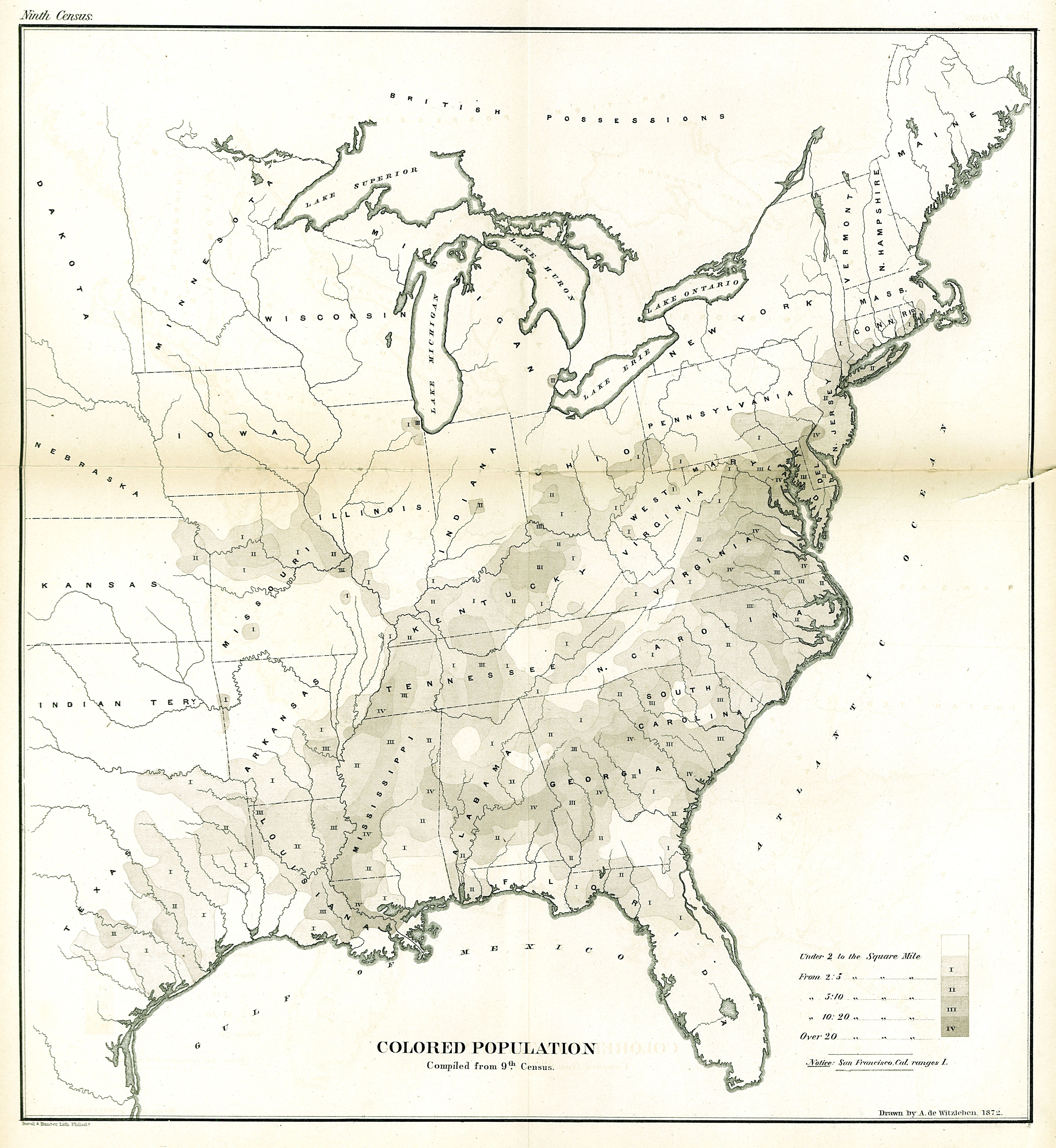
| Title | Map of the “Colored Population” Compiled from the Ninth Census
|
| Alternate Title | Map of the “Colored Population” Compiled from the Ninth Census
|
| Creator | Walker, Francis Amasa, 1840-1897 | Witzleben, Arthur de
|
| Type of Resource | cartographic
|
| Date Created | 1872
|
| Digital Origin | reformatted digital
|
| Topics | African Americans | Population | Census
|
| Places | United States
|
| Dates | 1870
|
| Subject Genre | Statistical maps
|
| Handle | http://hdl.handle.net/10176/codu:57812
|
| Rights Statement | Digitized and made available by the University of Denver Penrose Library solely for research and educational purposes. The user is responsible for all copyright, privacy and publicity rights compliance.
|
| Publisher | [Government Printing Office]
|
| Language | English
|
| Extent | 1 online resource (map) : TIFF file.
|
| Physical Note | Raster | Original Sheet(s): 42 x 39 cm.
|
| Scale | Scale not given.
|
| Coordinates | (W 99°--W 67°/N 49°--N 25°)
|
| Notes | » Website description: This map illustrated the black population in absolute terms rather than as a proportion of the overall population, as the Coast Survey’s map of slavery in 1861 had done. | » In lower left margin: Duval & Hunter Lith., Philad. | » In upper right margin: Ninth census. | » Includes index showing African-American population distribution in the United States in 1870. | » Alternate title from Website.
|
| Local Identifiers | n1872_Colored_Population.tif | nationID: 5.04 | nationIDchrono: 4.02 | nationIDcreator: 1.83 | (OCoLC)262479928 | (OCoLC)27462678 (Host)
|