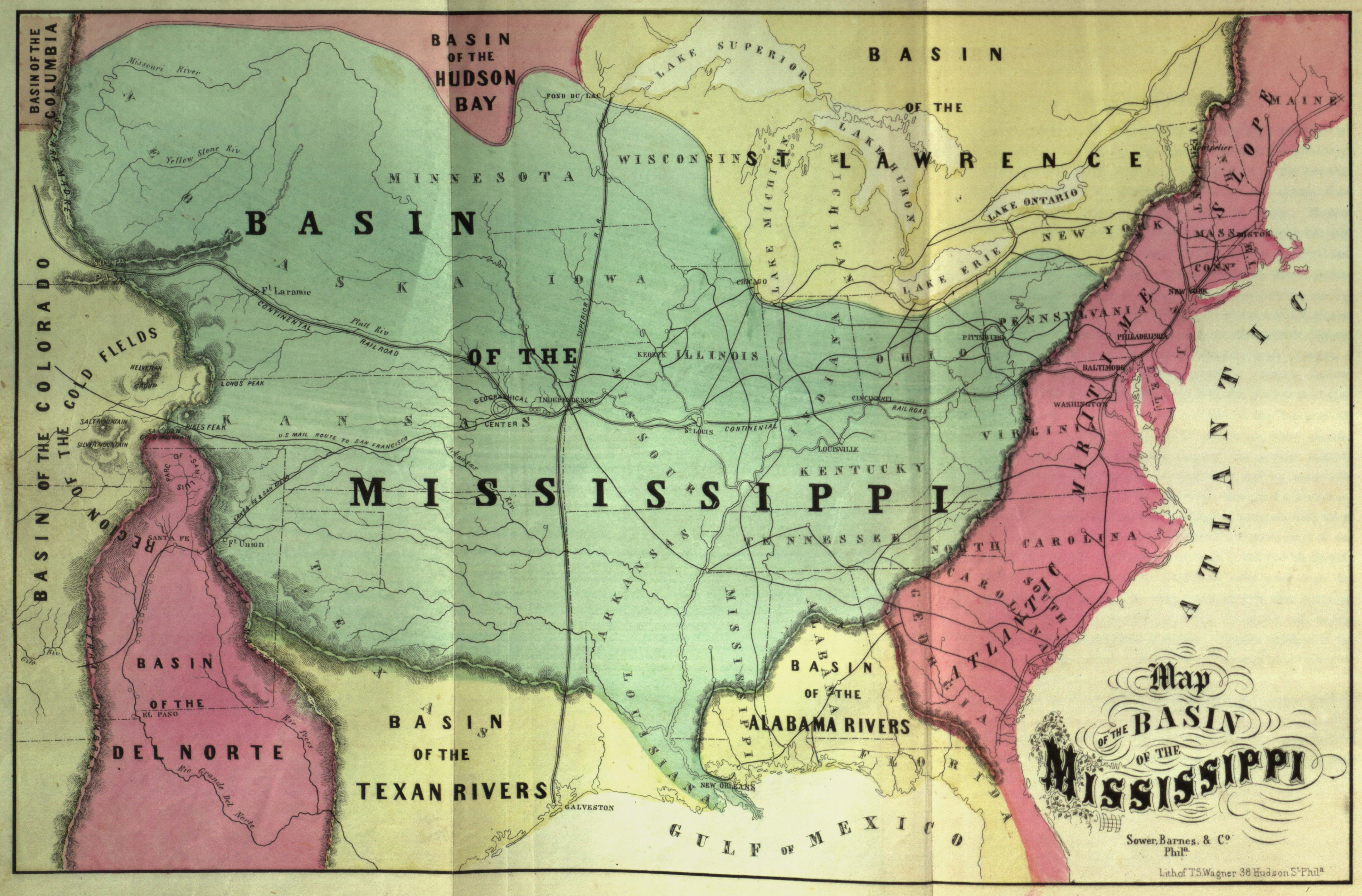
| Title | Map of the Basin of the Mississippi
|
| Alternate Title | Map of the Basin of the Mississippi
|
| Creator | Gilpin, William, 1813-1894
|
| Type of Resource | cartographic
|
| Date Created | 1860
|
| Digital Origin | reformatted digital
|
| Topics | Pacific railroads | Watersheds | Physical geography | Gold mines and mining
|
| Places | United States | Mississippi River Watershed
|
| Dates | Nineteenth century
|
| Subject Genre | Physical maps
|
| Handle | http://hdl.handle.net/10176/codu:57050
|
| Rights Statement | Digitized and made available by the University of Denver Penrose Library solely for research and educational purposes. The user is responsible for all copyright, privacy and publicity rights compliance.
|
| Language | English
|
| Extent | 1 online resource (map) : TIFF file, col.
|
| Physical Note | Raster | Original Sheet(s): 20 x 32 cm.
|
| Scale | Scale not given
|
| Coordinates | (W 111°--W 70°/N 50°--N 25°)
|
| Notes | » Website description: Gilpin emphasized geographical relationships to showcase the “great basin” of the interior, which he predicted would soon become the economic, political, and demographic center of the nation. | » Relief shown by hachures. | » Host/Source Creator: Gilpin, William, 1813-1894. Host Type of Resource: text. Host Extent: [iii]-xii, 13-194 p. : 6 fold. maps (incl. front.) ; 24 cm. | » Alternate title from Website.
|
| Local Identifiers | Map_of_the_Basin_of_the_Mississippi.tif | nationID: 3.21 | nationIDchrono: 2.30 | nationIDcreator: 1.25 | (OCoLC)15579847 | (DLC) 03021050 (Host) | (OCoLC)1667686 (Host)
|