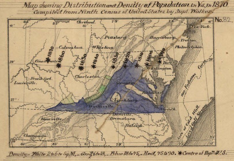
| Title | Map of Population in Virginia
|
| Alternate Title | Map of Population in Virginia
|
| Creator | Hotchkiss, Jedediah, 1828-1899
|
| Type of Resource | cartographic
|
| Date Created | 1874
|
| Digital Origin | reformatted digital
|
| Topics | Population | Census
|
| Places | Virginia
|
| Dates | 1870
|
| Subject Genre | Statistical maps
|
| Handle | http://hdl.handle.net/10176/codu:58111
|
| Rights Statement | Digitized by the Library of Congress. Rights assessment is your responsibility.
|
| Language | English
|
| Extent | 1 online resource (map) : JP2 file, col.
|
| Physical Note | Raster | Original Sheet(s): map 8 x 12 cm., assembled with 4 other maps to form sheet 36 x 30 cm.
|
| Scale | [ca. 1:10,000,000]
|
| Coordinates | (W 85°--W 73°/N 40°--N 35°)
|
| Notes | » Website description: Notice that Hotchkiss—a well-respected cartographer for the Confederacy—incorporated Hilgard’s “center of population” map in order to promote the centrality of Virginia after the Civil War. | » Alternate title from Website.
|
| Local Identifiers | Hotchkiss_Virginia_population.jp2 | nationID: 5.23 | nationIDchrono: 4.25 | nationIDcreator: 1.43
|