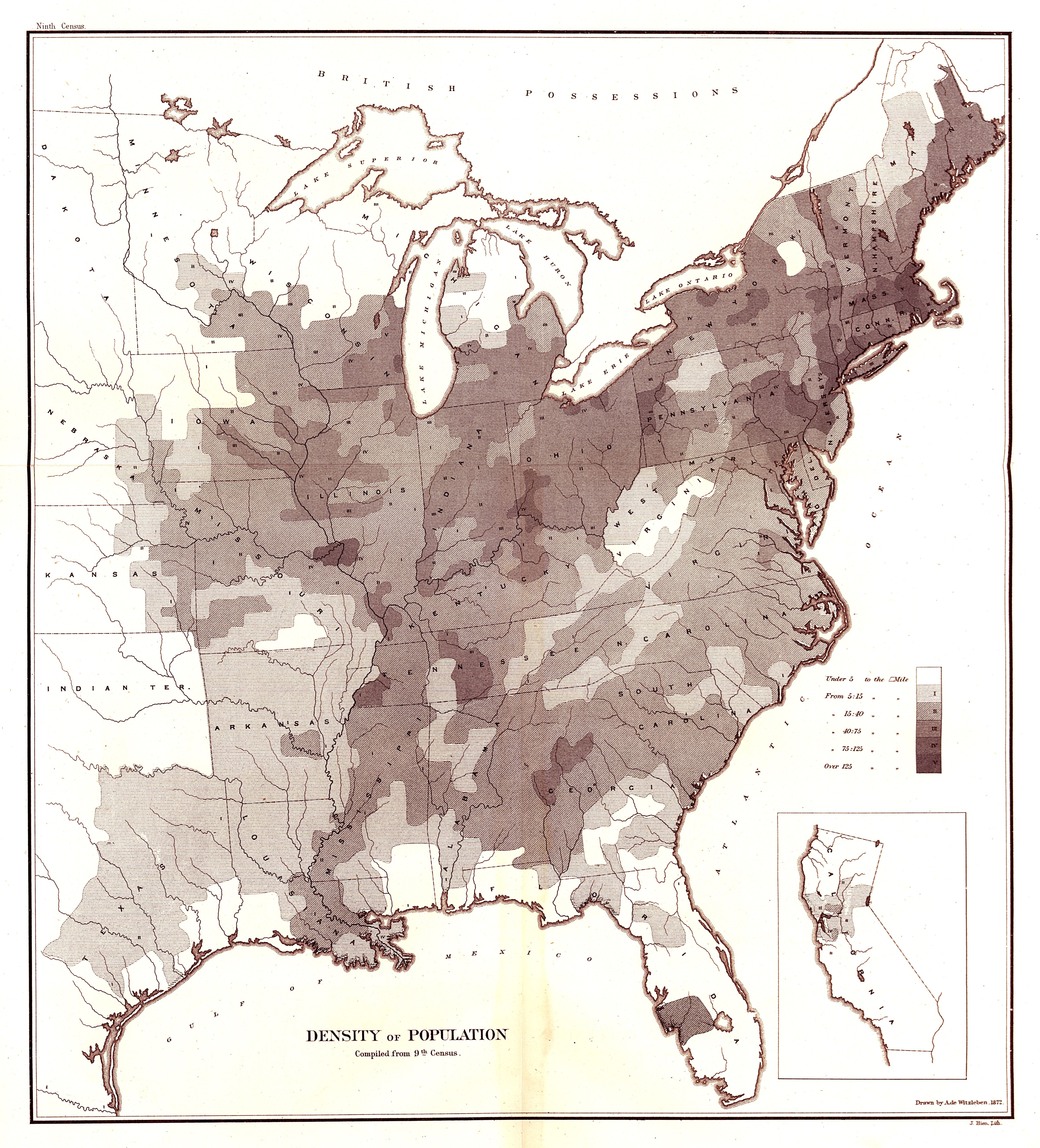
| Title | Map of Population Density Compiled from the Ninth Census
|
| Alternate Title | Map of Population Density Compiled from the Ninth Census
|
| Creator | Witzleben, Arthur de
|
| Type of Resource | cartographic
|
| Date Created | 1872
|
| Digital Origin | reformatted digital
|
| Topics | Population density | Census
|
| Places | United States | East (U.S.)
|
| Dates | 1870
|
| Subject Genre | Statistical maps
|
| Rights Statement | Made available by the University of Denver Penrose Library solely for research and educational purposes. The user is responsible for all copyright, privacy and publicity rights compliance.
|
| Language | English
|
| Extent | 1 online resouce (map) : TIFF file, col.
|
| Physical Note | Raster | Original Sheet(s): 42 x 38 cm.
|
| Scale | Scale not given.
|
| Coordinates | (W 99°--W 67°/N 49°--N 25°)
|
| Notes | » Website description: Here designed this early map of the 1870 census convince Congress to fund an atlas of the census. Walker’s decision to map density reflected his concern with the growth of urbanization. | » In upper left margin: Ninth census. | » In lower right margin: J. Bien, Lith. | » Includes legend indicating population density in the eastern United States in 1870. | » Ancillary map: California. | » Drawn by A. de Witzleben. | » Classification: G3706.E25 1870 .W583 Classification Scheme: lcc. | » Host/Source Creator: United States. Census Office. Host/Source Contributor: Walker, Francis Amasa, 1840-1897. Host Type of Resource: text. Host Extent: xlix, 804 p. : maps. Host Classification: HA201 1870 .A5 v.1 Host Classification Scheme: lcc. | » Alternate title from Website.
|
| Local Identifiers | n1872_Population_Density.tif | nationID: 5.05 | nationIDchrono: 4.03 | nationIDcreator: 1.107 | (OCoLC)613647790 | (OCoLC)27462678 (Host)
|