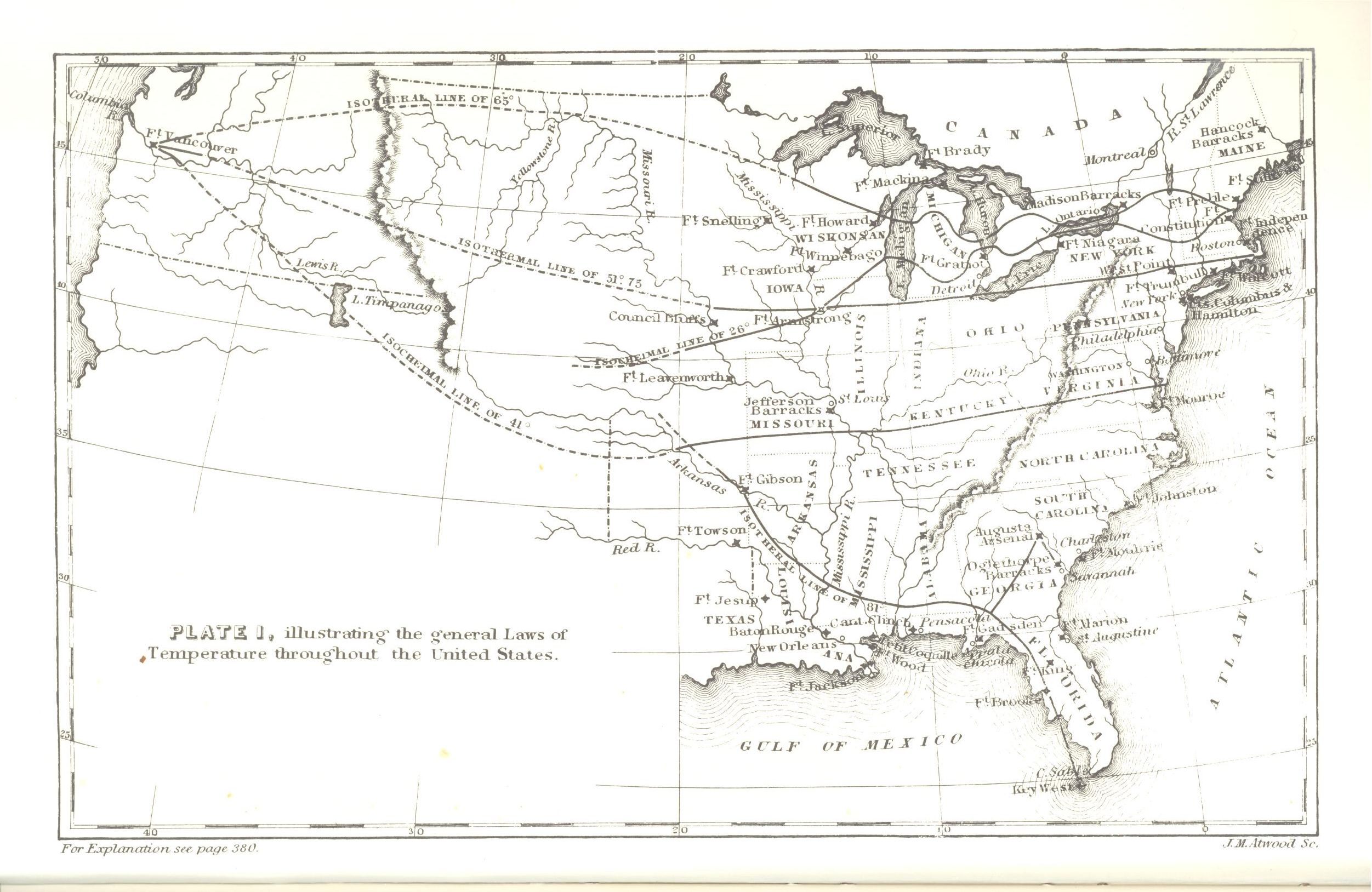
| Title | Map of Climate Patterns in the U.S.
|
| Alternate Title | Map of Climate Patterns in the U.S.
|
| Creator | Forry, Samuel, 1811-1844
|
| Type of Resource | cartographic
|
| Date Created | 1842
|
| Digital Origin | reformatted digital
|
| Topics | Medical geography | Atmospheric temperature
|
| Places | United States
|
| Dates | Nineteenth century
|
| Subject Genre | Thematic maps | Meteorological charts
|
| Handle | http://hdl.handle.net/10176/codu:55741
|
| Rights Statement | Digitized by the University of Denver Center for Teaching and Learning. Made available by the University of Denver Penrose Library solely for research and educational purposes. The user is responsible for all copyright, privacy and publicity rights compliance.
|
| Language | English
|
| Extent | 1 online resource (map) : JPEG file
|
| Physical Note | Raster | Original Sheet(s): 13 x 19 cm.
|
| Scale | Scale not given.
|
| Coordinates | (W 127°--W 72°/N 45°--N 25°)
|
| Notes | » Website description: Forry, a physician, made the first map of climate patterns at the request of the Surgeon General, to study the relationship between geography and disease. | » Principal meridian: Washington. | » Host/Source Creator: Forry, Samuel, 1811-1844. Host Type of Resource: text. Host Extent: xii, [13]-378, [2] p., 1 l. ill. : front. (map) diagr. ; 24 cm. | » Alternate title from Website.
|
| Local Identifiers | Forry_Temperature.jpg | nationID: 3.12 | nationIDchrono: 2.02 | nationIDcreator: 1.23 | (DLC) 35037880 (Host) | (OCoLC)8808031 (Host)
|