| Title | Land Use Maps, Series 3
|
| Alternate Title | Land Use Maps, Series 3
|
| Creator | Paullin, Charles Oscar, 1868 or 9-1944
|
| Type of Resource | cartographic
|
| Date Created | 1932
|
| Digital Origin | reformatted digital
|
| Topics | Land capability for agriculture | Land use | Clearing of land | Reclamation of land | Tenant farmers | Field crops
|
| Places | United States
|
| Dates | Nineteenth century | Twentieth century
|
| Subject Genre | Statistical maps
|
| Handle | http://hdl.handle.net/10176/codu:58144
|
| Rights Statement | Digitized and made available by the University of Denver Penrose Library solely for research and educational purposes. The user is responsible for all copyright, privacy and publicity rights compliance.
|
| Language | English
|
| Extent | 1 online resource (16 maps) : TIFF file.
|
| Physical Note | Raster | Original Sheet(s): 33 x 48 cm.
|
| Scale | Scale not given.
|
| Coordinates | (W 125°--W 70°/N 50°--N 25°)
|
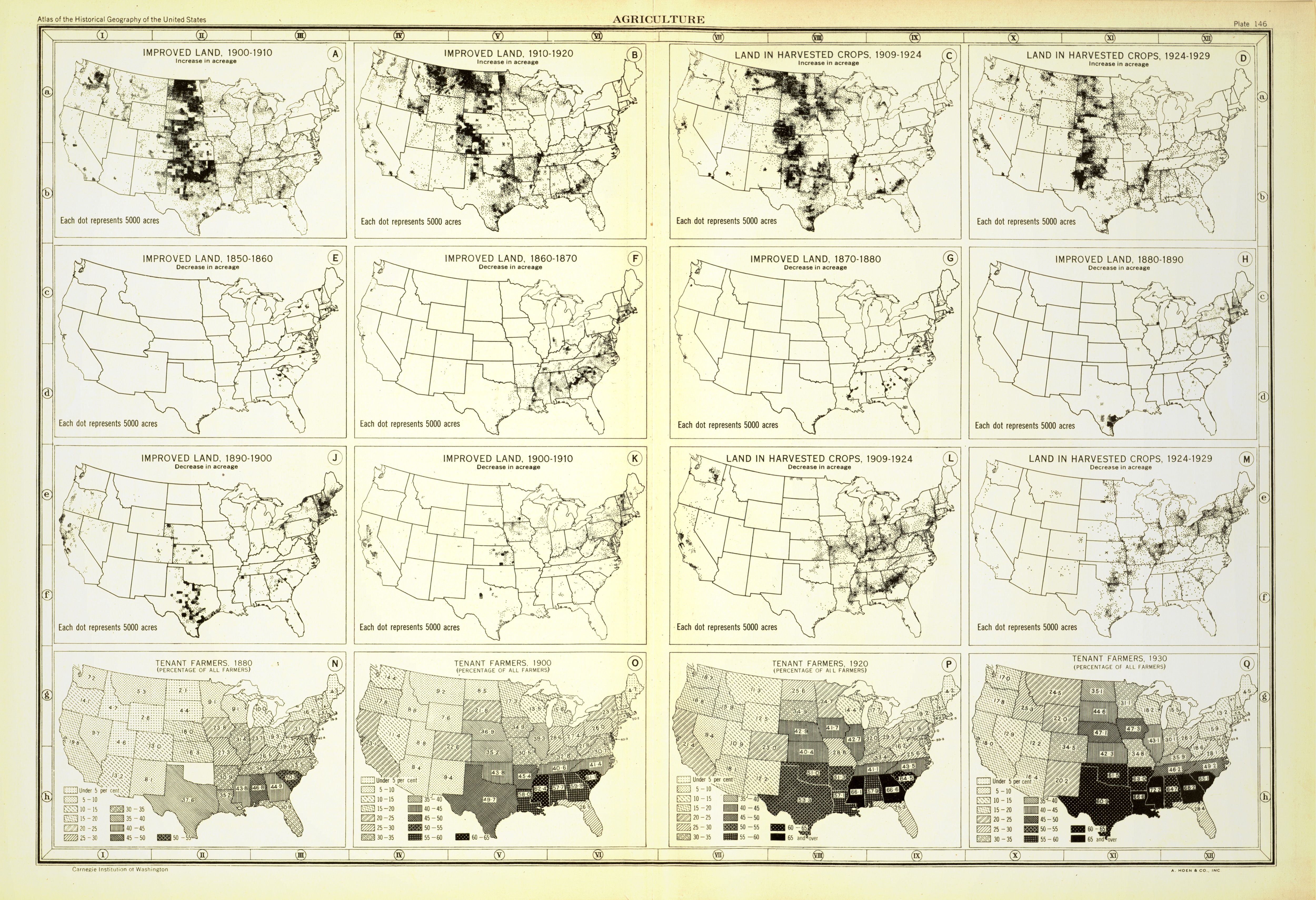
| Notes | » Website description: Geographer John Wright devised these maps to represent the dynamism of agricultural growth in American history. Each map represents change over a ten year period. | » Plate 146 | » Host/Source Creator: Paullin, Charles Oscar, 1868 or 9-1944. Host/Source Contributor: Wright, John Kirtland, 1891-1969 ; American Geographical Society of New York ; Carnegie Institution of Washington. Division of Historical Research. Host Extent: 2 p. l., iii-xv p., 1 l., 162 p., 1 l., 688 maps (part col.) on 166 pl. (part double) ; 37 cm. Host Classification: G1201.S1 P3 1932 Host Classification: lcc. | » Alternate title from Website.
|
| Local Identifiers | Paullin_Improved_Land_3.tif | nationID: 2.18 | nationIDchrono: 5.13 | nationIDcreator: 1.62 | (DLC)map32000054 (Host) | (OCoLC)52388225 (Host) | (OCoLC)13236525 (Host)
|