| Title | Isothermal Chart
|
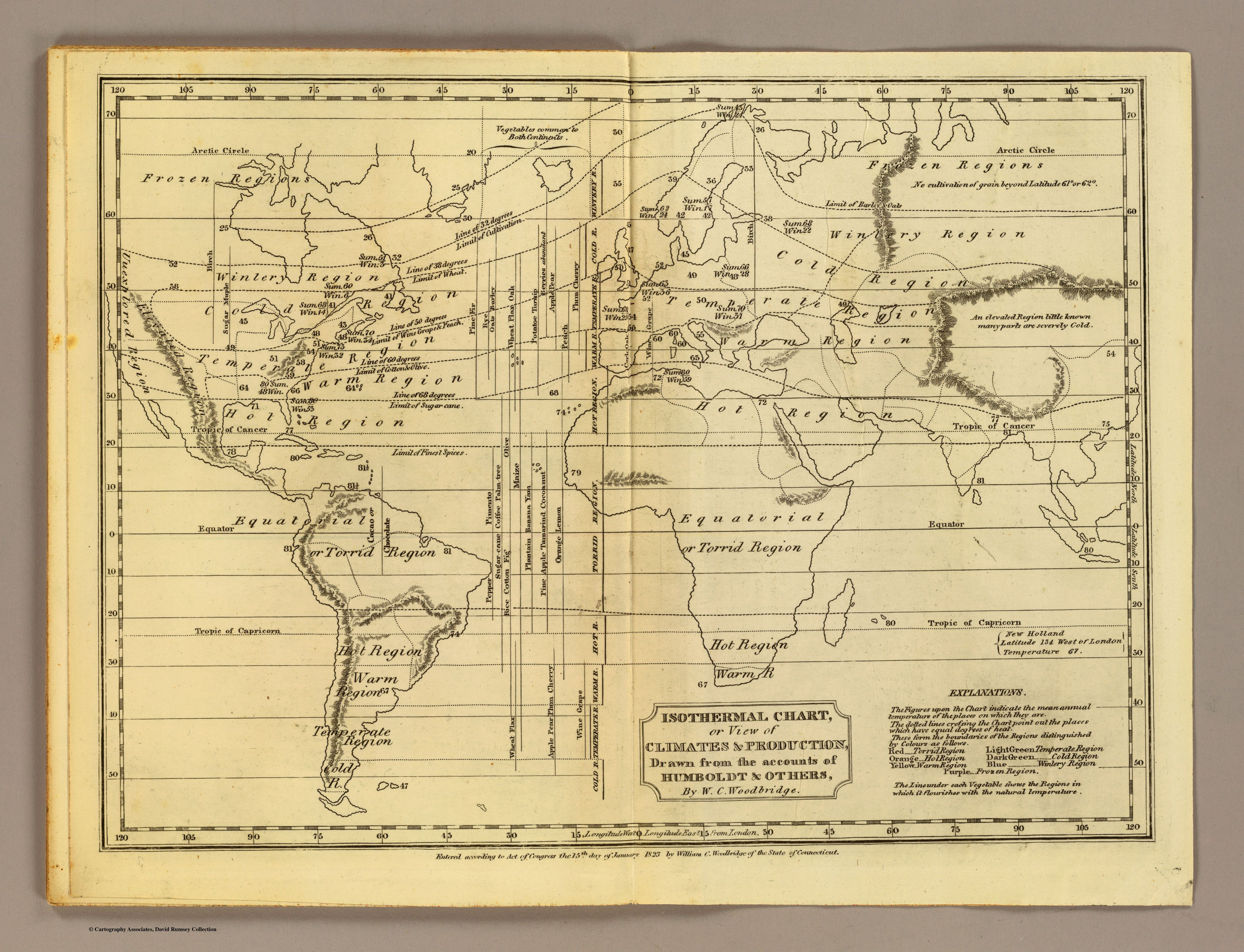
| Alternate Title | View of Climates and Production Drawn from the Account of Humboldt and Others | Isothermal Chart
|
| Creator | Woodbridge, William C., 1794-1845
|
| Type of Resource | cartographic
|
| Date Created | 1824
|
| Digital Origin | reformatted digital
|
| Topics | Climate
|
| Places | Earth
|
| Dates | Nineteenth century
|
| Subject Genre | Thematic maps | Meteorological charts
|
| Handle | http://hdl.handle.net/10176/codu:55745
|
| Rights Statement | Scanned image Copyright 2005, Rumsey Collection (Cartography Associates), and used here under Creative Commons Attribution-NonCommercial-ShareAlike 2.0 Generic license.
|
| Language | English
|
| Extent | 1 online resource (map) : JPEG file, col.
|
| Physical Note | Raster | Original Sheet(s): 27 x 43 cm.
|
| Scale | 1: 95,000,000
|
| Coordinates | (W 120°--E 120°/N 70°--S 60°)
|
| Notes | » Website description: This chart adopted Alexander von Humboldt’s innovation of isothermal lines in order to enable students to investigate the relationship between temperature and agricultural output. | » Includes inset map "Central Europe" and table "Distribution of mankind with their races & religions, 1826." | » Prime meridians: Philadelphia and London. | » Relief shown by hachures. | » Host/Source Creator: Woodbridge, William C., 1794-1845. Host Type of Resource: cartographic. Host Form of Resource: atlas. Host Extent: 8 double maps ; 25 cm. | » Last alternate title from Website.
|
| Local Identifiers | Woodbridge_Isothermal_Chart.jpg | nationID: 3.03 | nationIDchrono: 1.04 | nationIDcreator: 1.110 | (CSfRHMC)5031009 | (OCoLC)30023631 (Host)
|