| Title | Conquest of the South, 1861-1865
|
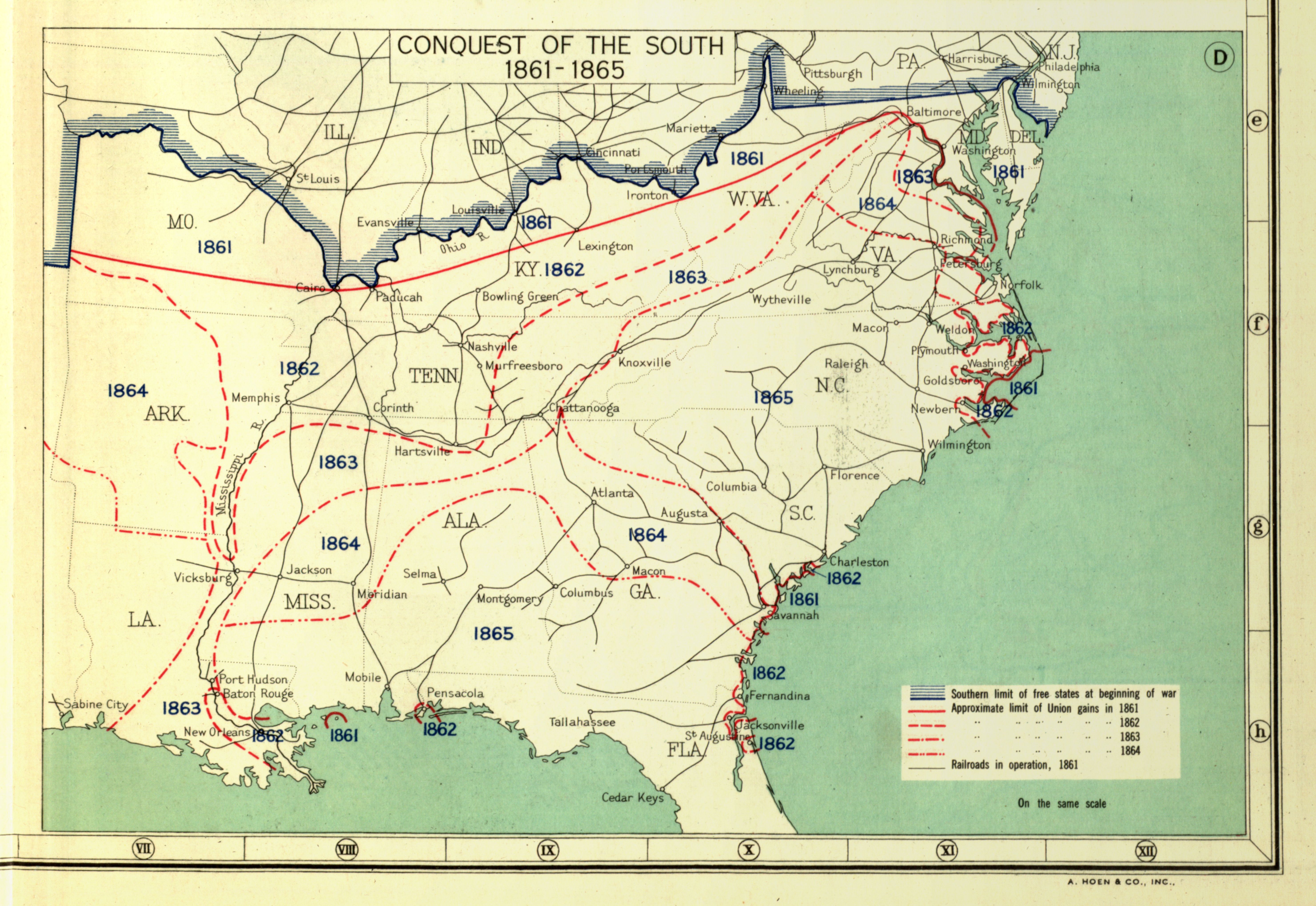
| Alternate Title | Plate 163 Map D | Conquest of the South, 1861-1865
|
| Creator | Paullin, Charles Oscar, 1868 or 9-1944
|
| Type of Resource | cartographic
|
| Date Created | 1932
|
| Digital Origin | reformatted digital
|
| Topics | Civil war | Federal-state controversies | History
|
| Places | United States | Confederate States of America
|
| Dates | Nineteenth century
|
| Subject Genre | Military maps
|
| Handle | http://hdl.handle.net/10176/codu:58018
|
| Rights Statement | Digitized and made available by the University of Denver Penrose Library solely for research and educational purposes. The user is responsible for all copyright, privacy and publicity rights compliance.
|
| Language | English
|
| Extent | 1 online resource (map) : TIFF file, col.
|
| Physical Note | Raster | Original Sheet(s): 16 x 23 cm.
|
| Scale | Scale not given.
|
| Coordinates | (W 94°--W 75°/N 41°--N 27°)
|
| Notes | » Website description: Here the Civil War is represented in stages, as popularized by Henry Lindenkohl and the U.S. Coast Survey in the “Sketches of the Rebellion,” included above. | » Host/Source Creator: Paullin, Charles Oscar, 1868 or 9-1944. Host/Source Contributor(s): Wright, John Kirtland, 1891-1969 ; Carnegie Institution of Washington. Division of Historical Research ; American Geographical Society of New York. Host Extent: 2 p. l., iii-xv p., 1 l., 162 p., 1 l., 688 maps (part col.) on 166 pl. (part double) ; 37 cm. Host Classification: G1201.S1 P3 1932 Host Classification Scheme: lcc. | » Last alternate title from Website.
|
| Local Identifiers | Paullin_conquest_of_south.tif | nationID: 2.14 | nationIDchrono: 5.09 | nationIDcreator: 1.64 | (DLC)map32000054 (Host) | (OCoLC)52388225 (Host) | (OCoLC)13236525 (Host)
|