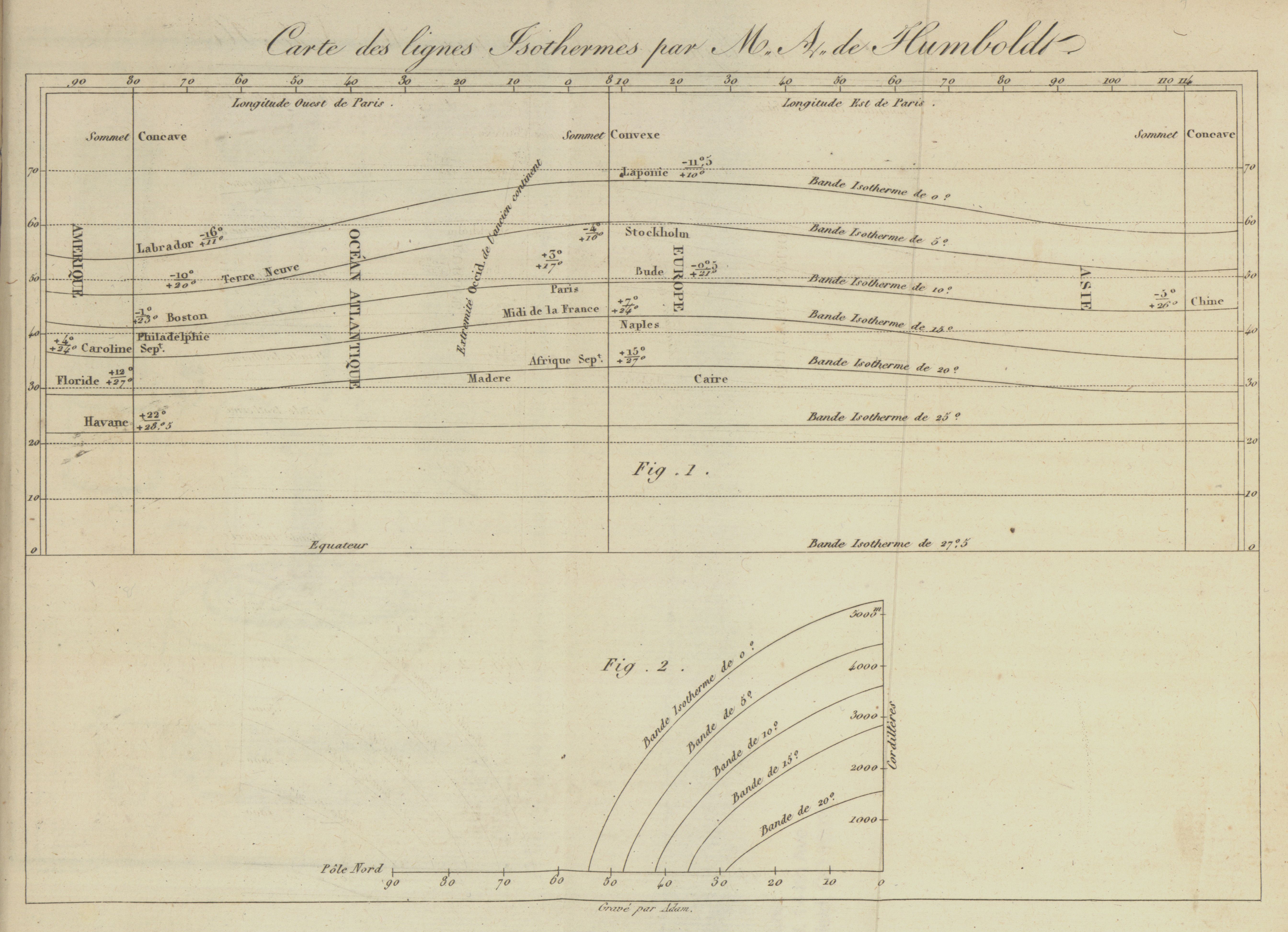
| Title | Carte des Lignes Isotherms par M. A. de Humboldt
|
| Alternate Title | Chart of equal temperatures | Carte des Lignes Isotherms par M. A. de Humboldt
|
| Creator | Humboldt, Alexander von, 1769-1859
|
| Type of Resource | cartographic
|
| Date Created | 1817
|
| Digital Origin | reformatted digital
|
| Topics | Atmospheric temperature
|
| Subject Genre | Statistical maps | Meteorological charts
|
| Handle | http://hdl.handle.net/10176/codu:58209
|
| Rights Statement | Digitized and made available by the University of Denver Penrose Library solely for research and educational purposes. The user is responsible for all copyright, privacy and publicity rights compliance.
|
| Language | English
|
| Extent | 1 online resource (map) : TIFF file.
|
| Physical Note | Raster | Original sheet(s): 18 x 23 cm.
|
| Scale | Scale not given.
|
| Coordinates | (W 90°--E 114°/N 70°--N 0°)
|
| Notes | » Website description: Humboldt devised this chart to represent lines of equal temperature, which enabled observers to think about the relationship between temperature patterns and other phenomena. | » Prime meridian: Paris | » Isoline chart illustrating a journal article. Isotherms shown on an east-west axis; inset shows them on a north-south axis. | » Last alternate title from website.
|
| Local Identifiers | Humboldt.tif | nationID: 3.01 | nationIDchrono: 1.02 | nationIDcreator: 1.47 | (OCoLC)1481242 (Host)
|