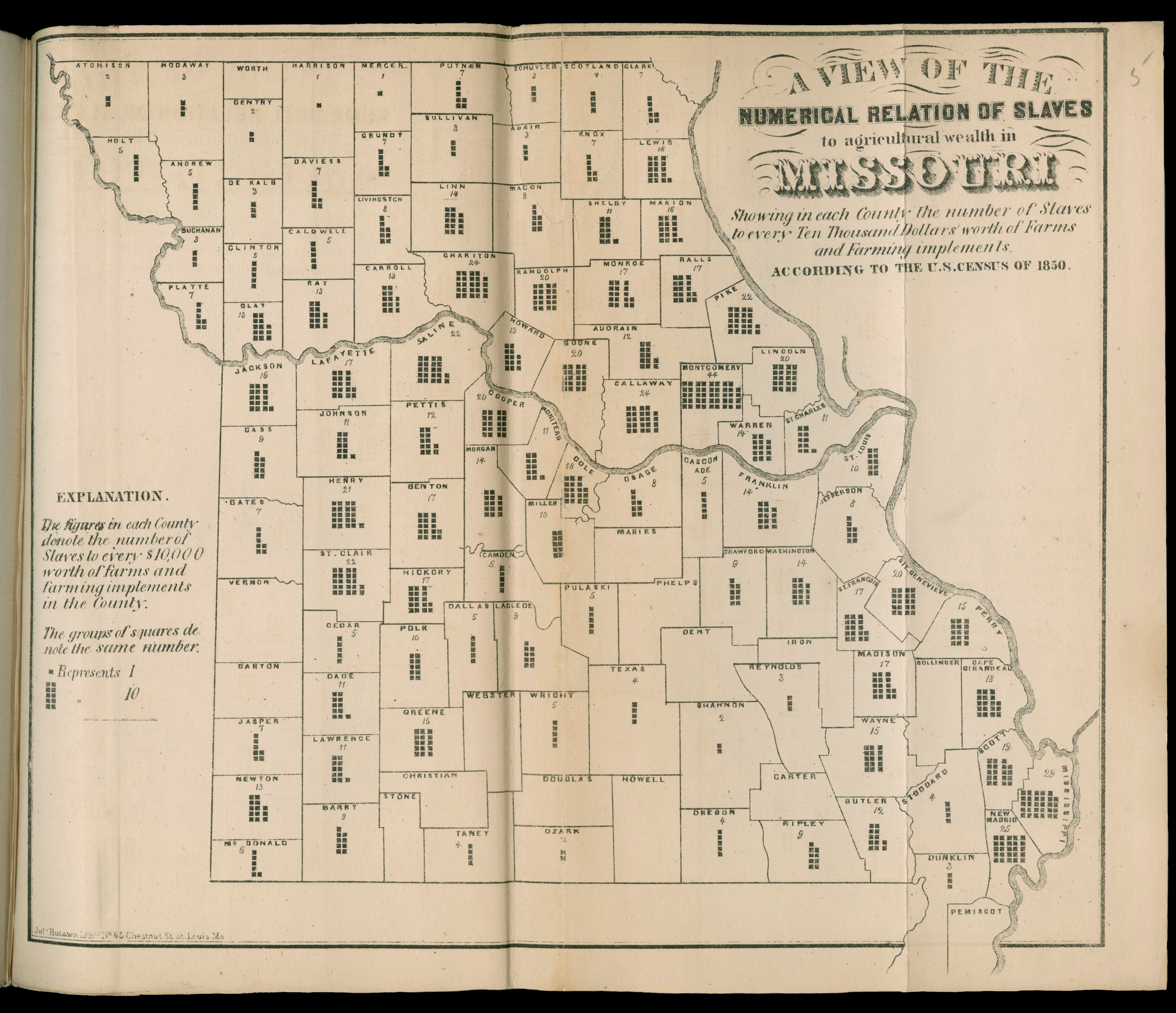
| Title | A View of the Relation of Slaves to Agricultural Wealth in Missouri
|
| Alternate Title | Numerical Relation of Slaves to Agricultural Wealth in Missouri | A View of the Relation of Slaves to Agricultural Wealth in Missouri
|
| Creator | Leigh, Edwin
|
| Type of Resource | cartographic
|
| Date Created | 1862
|
| Digital Origin | reformatted digital
|
| Topics | Slavery | Farms | Agricultural implements
|
| Places | Missouri
|
| Dates | Nineteenth century
|
| Subject Genre | Statistical maps
|
| Handle | http://hdl.handle.net/10176/codu:57051
|
| Rights Statement | Digitized map image courtesy of The Newberry Library; mounted here by permission, with "Non-exclusive world rights, English language, web use only, NON DOWNLOADABLE, 5 years only."
|
| Language | English
|
| Extent | 1 online resource (map) : TIFF file, col.
|
| Physical Note | Raster | Original sheet(s): 24 x 27 cm.
|
| Scale | Scale not given.
|
| Coordinates | (W 95° 42'—W 89° 6'/N 40° 35'—N 36°)
|
| Notes | » Website description: Leigh designed several maps to demonstrate the relative inefficiency of slave labor in Missouri, yet this includes so much information as to be difficult to understand. | » "Showing in each County the number of Slaves to every Ten Thousand Dollars' worth of Farms and Farming impliments. According to the U.S. Census of 1850." | » Host/Source Creator: Leigh, Edwin. Host Type of Resource: text. Host Form of Resource: monograph. Host Extent: 3 p. : 6 double maps ; 24 cm. | » Last alternate title from Website.
|
| Local Identifiers | Leigh_Missouri_Map.tif | nationID: 5.01 | nationIDchrono: 3.08 | nationIDcreator: 1.53 | (DLC) 10034476 (Host) | (OCoLC)11447649 (Host) | (NBYdb)505206 (Host)
|